Where Can Free Transit Work?

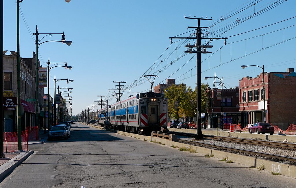
The question of whether public transit could be made free to ride has been gaining some considerable amount of media attention recently, driven in part by well-publicized (but uncertain) flirations in Paris and Germany. It is, of course, a sexy question, but one with very little track record and whose practicality is very much in question. There’s a reason that supporters of free transit point to the same few examples over and over again; there just aren’t that many cities that have experimented with fare-free transit. Even Communist countries have typically charged fares! But it’s a question that, quite reasonably in an age of increasing inequality, keeps coming up, whether from transportation writers in Chicago; lefty publications like Alternet (an article that, amusingly, comes to the standard bougie liberal conclusion that “people are just going to continue to drive, because they like it”); or extensively in the digital pages of Citylab.

Normally I’m kind of a killjoy on idealistic, speculative things like free transit. But I’m here to say that it’s something I’d actually like to see explored more–in very specific, limited circumstances. In an American context, someplace like Chicago–where tickets provide a significant chunk of the transit agency’s overall revenue picture–probably isn’t the place to start with free transit. By contrast, there are dozens if not hundreds of much smaller transit agencies in this country where farebox recovery (basically, and acknowledging that not every agency defines it the same way, the technical term for the percentage of overall operating expenses covered by ticket sales) is beyond low and in the “pathetic” (though understandably so) range. And I‘m interested in the topic of small-city transit. Luckily, Citylab has, in Eric Jaffe’s 2013 look at Chapel Hill Transit in North Carolina, already provided the beginnings of a blueprint for a situation where free transit might work:

The agency considered shifting to a fare-free system back in 2001 after recognizing that its farebox recovery rate was quite low — in the neighborhood of 10 percent. Most of its revenue was already coming from the University of North Carolina, in Chapel Hill, in the form of pre-paid passes and fares for employees and students. To go fare-free, the agency just needed a commitment from a few partners to make up that farebox difference. The university agreed to contribute a bit more, as did the taxpayers of Chapel Hill and Carrboro, and the idea became a reality…The original decision to go fare-free was part of a larger push by the community toward a transit-oriented lifestyle. In addition to eliminating bus fares, Chapel Hill Transit decided to expand service by about 20 percent. Meanwhile the university reduced parking on campus, Chapel Hill adjusted parking requirements in the downtown area, and the entire community made a push for denser development in the transit corridors. The ridership growth since 2002 can be seen as the result of all these efforts combined, says Litchfield.

To boil it down, the Chapel Hill experience seems to consist of the following factors:

  • A low farebox recovery rate
  • A strong institutional partner or partners to provide a built-in ridership base
  • Increasing service to build ridership
  • Political will to push transit-friendly land use and parking policies
  • Dedicated funding to cover deficits

I’d add a few items of my own:

  • Strong heritage land use patterns that are conducive to transit use, such as one or two strong transit corridors
  • Must be large or strung-out (think river towns) enough that transit, rather than biking and walking, is the appropriate sustainable mode
  • A high percentage of workers both live and work locally

Aside from the first item, that’s a fairly foreboding list in most of the US. But it’s not an impossible one! It’s just not likely to be one that’s found in major cities. Rather, we might more profitably (heh) seek the future of experimentation with free transit in the smaller towns whose problems sometimes mimic those of big cities.

Let’s take a crack at identifying a few candidates. Given the criteria I’ve laid out–and my own geographic biases–my candidates will cluster in the Northeast US. I invite others to contribute other candidates!

Brattleboro, VT

Population: 11,765

Operating Agency: Southeast Vermont Transit (formerly Connecticut River Transit and Deerfield Valley Transit)

2016 NTD-reported fixed-route farebox recovery (fare revenue/operating expenses): 7.7% (note: reported number includes entire former Connecticut River Transit service area)

Percentage of town workers employed within town (2015 LODES): 52.7%

brattleboro

Brattleboro, via Bing Maps

Brattleboro’s a cute little town that’s a significant tourist and out-of-towner draw thanks to its hippie reputation, antiquing, its quaint and intact downtown, and the Brattleboro Retreat. The same intact downtown offers relatively limited parking and can get congested at busy times.

brattleboro parking_lots_Rev_11.16.12

Brattleboro downtown parking lots, via the town’s website. Hey, that’s not actually so many!

Most of the town’s major employment centers are either downtown or centered on one of 3-4 major arterials, an ideal situation for serving them with transit–and, by small city standards, a quite high percentage of Brattleboro workers also work in town. Residential development is a little more spread out but mostly centered on linear corridors as well. Service radiates from the downtown transit center serving communities up and down the Connecticut River Valley and also across the mountains to Wilmington and (with a transfer) to Bennington, albeit not with any great frequency. Amtrak’s Vermonter stops very near downtown once a day in each direction. Given the current atrocious rate of farebox recovery and the town’s liberal politics, it’s at least mildly plausible to imagine a future in which Brattleboro decides to make a major push on bringing people downtown by transit and fills in its remaining downtown parking lots to help pay for it (and provide a push).

Sandusky, OH (h/t Bryan Rodda)

Population: 25,793

Operating Agency: City of Sandusky

Farebox recovery: unclear (not reported to NTD but it seems to lose a lot of money)

Percentage of town workers employed within town (2015 LODES): 26.1%

sandusky

Sandusky, via Bing Maps

Sandusky is a touristy town on Lake Erie, home to the Cedar Point amusement park and a variety of other attractions. The downtown is somewhat disinvested but hasn’t been totally wiped out by urban renewal. Commercial development clusters along major corridors, but the percentage of locals who have managed to find work in town is, according to LODES, fairly low (though not terrible by the standards of a city this size). There seems to be a lot of room to grow–and perhaps free transit would be the way to make that happen.

Rutland, VT (h/t @peatonx)

Population: 16,495

Operating Agency: Marble Valley Regional Transit District

Farebox Recovery (NTD 2016): 3.8%

Percentage of town workers employed within town (2015 LODES): 45.4%

rutland

Rutland, via Bing Maps

Hometown of Boston-area urbanist journalist Matt Robare (support his Patreon!), Rutland is a down-on-its luck former quarrying town with some proximity to ski resorts. It’s a reasonably dense town with a few obvious transit corridors and some decent job concentrations, and a fairly high proportion of local workers work in town, while others surely would happily ride transit to ski resorts such as Killington. There’s room for infill, too, such as the giant strip mall that sits on top of the former railroad yards; but residential growth is anemic and locals have rejected plans to bring refugees to the area. Rutland is struggling economically, though, and lacks the kind of major anchor institutions that could typically provide funding, so despite the local transit system’s terrible farebox recovery finding more funds to make transit free may be a no-go.

Michigan City, IN

Population: 31,479

Operating Agency: Michigan City Transit

Farebox Recovery (NTD 2016): 7.8%

Percentage of town workers employed within town (2015 LODES): 38.7%

michigan city

Michigan City, via Bing Maps

A sometime muse of mine, Michigan City is an interesting place because by the standards of small Midwestern cities it’s quite transit-rich, offering both Amtrak and South Shore Line rail service to Chicago, even if the two operators don’t cooperate quite as much as they should. It is, otherwise, a quasi-Rust Belt town that has struggled to reinvent itself; urban renewal and a casino have, predictably, not yielded much in the way of results. Aside from good rail service, it has the transit advantage of having one very strong, identifiable north-south transit corridor along Franklin Street around which much of the city’s employment clusters and that connects to both the South Shore and Amtrak. Land use in that corridor is far from ideal, and residential demand is mediocre, but this is a classical “good bones” case.

Conclusions

I’ve offered, I think, a few plausible real-life cases where free transit could work. But the case studies here also demonstrate the difficulty of making such a dream reality. Some of these towns would almost certainly lack the ability to raise sufficient funds locally to make transit free; it’s hard to imagine, say, Rutland or Michigan City finding the money. You can’t tax the wealthy or major corporations to make transit work when capital–not to mention major corporations–has already abandoned your city. And local funding streams, even when feasible, are notoriously fickle; even Chapel Hill Transit has had to consider charging fares at at least one point. To  make free fares work while also increasing service to the point where it could make a real difference in the life of the city would probably require a substantial, long-term commitment from a higher level of government, but I would be very interested in seeing a wealthy state or the federal government take this on as an experiment. The money pouring in, of course, would have to be matched by local measures on land use, parking, and planning, which makes the entire exercise fraught. But it’s not hard to envision something potentially working. It’s certainly worth more experimentation.


Coordinating Passenger Rail in Northwest Indiana

Northwest Indiana famously hosts one of the most complex rail networks on the planet. As a book I once read (I can’t remember which) argued, the “logical” place for Chicago to have been from a railroad perspective would have been about 30 miles east of its current location, perhaps near Whiting, IN. Instead, with the nation’s rail network divided at the location of an ancient portage, the “Eastern” railroads had to converge in the extreme northwesterly corner of Indiana and make a near-90-degree turn to run into Chicago. The result was a tangled mess of conflicting rights-of-way, industrial tracks, and infrastructure that has only been somewhat simplified by the mergers and consolidations of recent decades.

Two passenger railroads try to pick their way through this mess, with varying degrees of success over the years since the destruction of American passenger service in the ‘60s and ‘70s. The Chicago, South Shore, and South Bend, “America’s last interurban,” now under public ownership as the Northern Indiana Commuter Transportation District (NICTD) operates a relatively conventional commuter service into Chicago, blended with an intercity operation reaching South Bend. Amtrak operates two long-distance trains along Norfolk Southern’s ex-New York Central Chicago line between the East Coast and Chicago, the Lake Shore Limited to New York City and the Capitol Limited to Washington, D.C.; a number of daily roundtrips to points in Michigan that leave the Chicago Line at Porter, IN; and the Hoosier State/Cardinal to Indianapolis (and beyond, three days per week).

schematic 1

Northwest Indiana rail network. Legend applies to all maps in this post.  Apologies for any sloppiness–I’m still learning QGIS–and for the general crappy resolution of the maps (I can’t get WordPress to upload them at anything near full resolution). 

The Northwest Indiana rail network remains seriously congested (as does the entire extended Chicago area), but both the South Shore and Amtrak have begun infrastructure plans that would allow their operations through the area to become speedier and (especially) more reliable. Unfortunately, in typical American railroading fashion, these projects are being planned and executed in a terribly siloed and completely uncoordinated fashion, whereas a degree of sharing infrastructure and cooperative thinking could go a long ways toward speeding trips and cutting down on unnecessary spending. Since Ted asked me why they don’t work together (and I’d actually been thinking about it for a while), here’s my attempt at analysis.

Though it’s more or less been in stasis for 60 years, the South Shore is pursuing an ambitious slate of improvements. The West Lake Corridor would use an abandoned right-of-way to create a branch from Hammond to Dyer; the latter town is currently not directly served by passenger rail. Closing the gaps in double track between Gary and the South Shore’s hub in Michigan City would increase capacity and move the railroad further from its interurban roots. The Michigan City realignment project would move the tracks through that city out of the middle of 10th and 11th Streets–the last place in the country where full-size electric passenger railcars run in mixed traffic, true interurban style, with cars on a city street–and create a dedicated rail right-of-way. Shortening the currently convoluted route to the terminal at the South Bend airport might need some use of eminent domain but could shorten trips by up to 10 minutes. While local and state commitments have generally been forthcoming, federal funding for these projects remains somewhat uncertain.

Meanwhile, Amtrak’s Michigan Line–which is owned by the national carrier from Porter to Kalamazoo, and Michigan DOT from Kalamazoo to Dearborn–has been the target of a gradual improvement process, with running speeds now up to 110 mph along much of its length. Amtrak has also partnered with Indiana and Norfolk Southern on the Indiana Gateway project, a $71 million first crack at decongesting the Chicago Line to benefit both corridor and long-distance trains. All of these improvements exist in some relation to the long-standing multi-partner attempts to “fix” the Chicago rail network, most notably CREATE; Amtrak has contributed a report from its own blue ribbon panel on the Chicago gateway…which concluded that the Indiana Gateway project  “will not increase speeds, or provide capacity for planned additional passenger trains” (p. 20), although it will increase reliability.

Notably, the South Shore and Amtrak efforts, while each ambitious in their own right, have seemingly proceeded completely independently, without any effort to coordinate service or investment. This is perhaps most remarkable given that Amtrak’s Northwest Indiana efforts mainly center around mitigating the impact of–or avoiding entirely–the congested NS mainline and especially the infamous Porter Junction, where the Michigan Line branches off. South Shore’s right of way, meanwhile, intersects with Amtrak routes at several points and avoids Porter entirely. While the South Shore’s capacity is currently constrained by single track, it is actively seeking to undo that constraint, yet lacks money; Amtrak often manages to pull in multi-state political support for a decent amount of funding, but none of the alternatives studied in the South-of-the-Lake Route Analysis involve bringing that funding potential to bear to consolidate trains from both railroads on a double-track South Shore. Indeed, depending on where the connections are made, a joint Amtrak-South Shore route from Michigan City into Chicago could be shorter than the route that trains from Michigan currently take. To the maps!

Assumptions I make in this analysis are as follows:

  1. Both railroads are interested in avoiding as much freight congestion as possible.
  2. The most nefarious and hard to avoid congestion is in Indiana, roughly from Hammond to east of Porter; from the Illinois line to Chicago Union Station, extra room exists on the NS ROW for dedicated passenger tracks, waiting only for funding. (indeed, Amtrak’s Chicago Gateway report says NS has promised access to a dedicated ROW–at cost, of course–from CUS to Buffington Harbor, contingent on Amtrak coming up with the money)
  3. Amtrak values improvements to reliability as well as overall speed.

Long-Distance Trains

Let’s work our way from east to west, or from the perspective of a westbound train. Perhaps the most ambitious way for Amtrak and the South Shore to coordinate would be for the East Coast long-distance trains to transition from the Chicago Line to the South Shore in South Bend, avoiding almost all of the congestion on the Chicago Line. The transition could happen either in South Bend proper (perhaps in conjunction with bringing South Shore service to South Bend Union Station rather than its current terminus at the airport)

sb1

Or perhaps better near the hamlet of Hudson Lake, a few miles west; the lines are completely parallel between South Bend and Hudson Lake, but diverge after that.

hudson lake 1

Now, maybe the single track eastern end of the South Shore can handle two more round trips per day–and trips with less-than-reliable timekeeping, at that–or maybe it would need some capacity enhancements. There might be some clearance issues; while the Lake Shore Limited uses single-level equipment that can operate under catenary, the Capitol Limited runs with Superliners that might be too close to the wires for comfort–and can’t use the high platforms that the South Shore has at many stations. But the point is that in a potential scenario of maximum cooperation, the two LD trains could be diverted to a dedicated passenger track many miles from Chicago; whether the work necessary to make this possible is desirable is not really the focus of this post.

Fixing Michigan City

Let’s face it: there’s very little more fun for railfans or transit geeks than standing on the sidewalk of a small Midwestern city and watching trains rumble down the middle of a residential street (been there, done that; I’m pretty sure even my non-railfan parents enjoyed).

But it’s also antiquated, a massive constraint on capacity, and downright dangerous, which is why the South Shore and the city are in the process of relocating the tracks to a dedicated reservation. That being said, while it’s something of a judgment call, I’m less than fond of the alternative that was ultimately decided upon in Michigan City; I’d rather have seen something like Options 4, 5 or 6 as presented in the Alternatives study, moving the tracks off city streets entirely and onto an abandoned right-of-way that’s currently a trail, with a new central station near Michigan City’s Amtrak station, closer to the lake (it’s not really clear how the study team reached its conclusion, given that their evaluation matrix really shows Option 4 should have been chosen–it costs the same, has greater TOD potential, and eliminates more grade crossings than the chosen Option 1–but I digress). Notably, none of even these alternatives–which all proposed building a station adjacent to the Amtrak one–even considered running South Shore trains on the Amtrak tracks through Michigan City, even though not doing so required more property takings. Sigh.

Anyhow, perhaps the most important link in creating a joint South Shore-Amtrak line is the connection that’s possible just west of Amtrak’s current Michigan City station.

mcity 4

Whether or not the long-distance trains are re-routed onto the South Shore, the Michigan corridor trains can use an upgraded connection through the grounds of the NIPSCO power plant (the tracks are owned by the South Shore) to access the theoretically double-tracked South Shore main toward Gary and Chicago. This is one of the straightest, fastest sections of the South Shore; running largely through a state park, the intermediate stations see little traffic. Where the Michigan trains might switch to the NS alignment is covered below; but sharing the South Shore segment for the 10-15 miles west of Michigan City would eliminate the jog south and then north again that they currently make, as well as avoiding Porter Junction entirely, which is probably worth tens of millions in and of itself.

Western Connections

There are three possible locations for a western connection between the NS/Amtrak alignment and the South Shore main. The easternmost is where the two lines crisscross at Burns Harbor; a connecting track already exists and could be upgraded.

burns harbor 3

The middle is just east of Miller station on the South Shore, marking the point where the Chicago Line and South Shore diverge somewhat geographically. The two lines are parallel and right next to each other and a connecting track would be easy to install, though not already extant.

miller1

The South Shore alignment through Gary is interurban-y; while grade-separated, it’s somewhat twisty and slow, so transitioning back to the Chicago Line at Miller saves time and distance. But as I understand it NS has not guaranteed there’s ROW to be purchased for dedicated passenger tracks this far east; while I’m sure an alignment could be found, given the absolutely massive amount of legacy rail infrastructure in the industrial wastelands between Miller and Buffington Harbor, it might be easier in the short term to keep Michigan trains on the South Shore further west (which would also allow a stop at Gary Metro Center).

The westernmost potential connection point also involves the most infrastructure. The South-of-the-Lake analysis envisions an exclusive Amtrak line branching off the Chicago Line at Buffington Harbor, running south and east along abandoned and underutilized ROW to loop around Gary to its south. Such a loop would pass under the South Shore near Gary-Chicago “International” Airport; connecting there, rather than looping further south (what a truly silly idea the loop is) would be relatively trivial, although there is an elevation difference to be dealt with.

buff1

The Buffington Harbor-Gary Airport connector would subject Amtrak trains to a relatively slow slog through Gary on South Shore trackage, as well as somewhat congesting the busiest part of the South Shore system, and it would require the most new infrastructure (several miles of track). But there is definitely room for dedicated passenger tracks west of Buffington Harbor, meaning that placing the connector here would for sure allow reliable all-passenger running from CUS through to Michigan City and beyond (once funding is found, of course).

Recommended Course of Action

With separate planning, funding, and construction processes proceeding apace, it may be hard to really coordinate Amtrak and South Shore infrastructure improvements to the extent I’m recommending here. And of course I haven’t answered the question of why the two agencies haven’t tried working together; I rather suspect NICTD guards its infrastructure and capacity jealously and doesn’t want to give Amtrak (which wants to ramp up Michigan service to ten round trips per day) a toehold on their main line. But I’m not familiar enough with the local politics to know, exactly.

That being said, the South Shore double-track project is not particularly expensive, will give a solid ROI, and seemingly has a strong local funding commitment. Adding in a connection to the Michigan Line through the NIPSCO plant in Michigan City and a link to the NS Chicago Line at Miller would allow Amtrak corridor trains to bypass Porter and many miles of the congested Chicago Line (although an overlay of Amtrak’s ITCS PTC system might add some costs). Hell, NS might even pay for some of the costs, just to get the Amtrak trains out of its hair. Amtrak should angle to join the double-tracking project; help pay for it; and consider its options for the western end. Probably, Miller makes the most sense for the western connection; but if the various parties can’t find room for passenger tracks between Buffington Harbor and Miller, the westernmost connection option might be more reasonable.

With the core piece in place and protocols for cooperation in place, Amtrak and NICTD can consider whether diverting the LD trains to the South Shore makes sense. The variables are probably too numerous to prognosticate here: whether Superliners can be squeezed under catenary; whether the single-track eastern end of the South Shore has room for more trains without more double track; platform heights and clearance; whether the new Michigan City alignment can accommodate Amtrak trains; and the like.  But it’s at least worth thinking about; while both LD trains are highly unreliable and encounter delays along the entire route, the section between South Bend and Chicago tends to be especially bad.

Addenda

A few further notes:

  1. I’ve treated the Amtrak Michigan trains here as if they all use the Michigan Line, but there’s one that doesn’t: the Chicago-Grand Rapids Pere Marquette, which runs once per day in each direction, diverging from the Chicago Line onto CSX rather than Amtrak’s own trackage at Porter. The Pere Marquette route actually crosses the South Shore just east of the latter’s Carroll Street yard and headquarters in Michigan City, and an interchange track exists for freight. It then crosses the Michigan Line just north of New Buffalo, MI, and should money become available a connection should really be built there, in which case the Pere Marquette would become just another corridor train for the purposes of this analysis (other than the fact that it often runs with Superliners, which would mean platform issues at some South Shore stations…).
  2. Austin brought up the idea of using the planned NICTD Dyer branch to divert Amtrak’s Hoosier State/Cardinal to the South Shore from Dyer into Chicago. These two trains currently encounter a significant amount of their massive delay problems west of Dyer as they traverse dense, congested rail infrastructure like Dolton interlocking. It’s not a bad idea; while somewhat roundabout, running the Indianapolis trains north along the Dyer branch and then along the South Shore/Metra Electric mainline to Grand Crossing would improve reliability considerably, though it would require completion of the CREATE Grand Crossing connection first. Perhaps Austin or I will explore this more in the future.
  3. Running Amtrak’s Michigan trains along the South Shore west of Michigan City would make the Amtrak-owned tracks between Porter and Michigan City redundant; perhaps they’d be retained for emergency diversions, or perhaps the South Shore freight operator could find a use for the line.


Building Urbanism and Transit in Small Cities

I’ve been following updates from the APTA conference in the Twin Cities this past week via Twitter and a friend who works in the area. A couple of the tweets I saw really caught my eye and helped to crystallize some thoughts I’ve been having for a while, since thinking about the role of transit in smaller cities during my time in Albany.

The state of transit in the US is, generally, pretty damn poor, and this is especially true of smaller cities and towns. I’ve written a lot about cities in the size class of Albany, New Haven, or Providence, say in the 100,000-500,000 range, but I’m talking here about somewhat smaller cities, places like–to use near-Albany examples–Utica or Kingston. Generally, transit in those places is, shall we say, not particularly useful; generally it’s conceived of as a last resort, welfare transit, the kind of thing that only people with no other options use. That’s a product of mentality, but also of lack of resources.

But here’s the thing I’ve learned from exploring Upstate New York, much of New England, and a few choice parts of the Midwest: a lot of the older cities, even (in some cases especially) the smaller ones, really do have “good bones.” They are potentially salvageable as places of good, safe, walkable mixed-use urbanism. But there’s a catch–often, in my experience and observation, this is true only in one or two choice corridors. A city like Albany or New Haven might have several or numerous corridors appropriate for high-frequency transit and dense urbanism, but smaller towns may only have one. In both cases, the most urban corridor is likely underserved, because of the general terribleness of American transit; but in the smaller cities, this likely means that the city has lost any chance at transit-based urbanism at all.

In transit-planning terms, small-city transit leans quite heavily toward the coverage side of the coverage vs. ridership debate. That’s not a criticism, per se; it’s how the incentives–including funding incentives–are biased, as well as how local leadership generally directs transit agencies to operate. This is, of course, in direct conflict with the first point that Erik Landfried made in the tweets presented above–that the best practice in the transit world is to get your best corridors right first. So this post is, in part, a thought exercise about how small-city transit might look if more funding–or different funding–were available, enough to let agencies focus on intensive service on the best corridors.

It’s also a musing on the future of smaller cities. It’s not news that many of these places are struggling, facing economic marginalization and brain drain. In part–though only in part–those struggles derive from a lack of good urbanism; with terrible transit and general unwalkability, those who want or need an urban lifestyle often literally cannot find it in smaller cities. As Cap’n Transit has pointed out, these “small city exiles”–people who would have been able to stay if the good bones of smaller cities had better flesh built upon them–make up one of the gentrifying flows to larger cities. Note that this isn’t just a Creative Class follow-the-talent kind of a thing; it seems clear that smaller, fully car-dependent cities are simply inaccessible to many.

Whether Small City Exiles follow the jobs, or the jobs follow them, is of course a little bit of a chicken/egg problem, but it seems unlikely that many will return without the option of urbanism. The implication is that to have a shot at revival struggling smaller cities would do well to try to build at least one corridor where life can be conducted in a car-free (or, more realistically, car-lite) manner. Typically, discussions of urbanism, revival and/or gentrification occur at the neighborhood level, but one of the things that I think this typology of city can teach us is that the relevant unit may in fact be corridors. Not all efforts at revival have to be focused in one area; but there should be an emphasis on creating the ability to live urban daily life–with all of the uses that entails–along at least one given corridor in any city. That means frequent transit service; it means reviving or allowing mixed-use development; it means locating hospitals and schools and shops along that corridor to the extent possible. It’s the preservation, revival, or creation of these corridors that will make a small-city revival through urbanism possible. And it means that the identification and intentional development of these one or two possible transit/urbanist corridors is extremely important to the future of these cities.

What I’m aiming for here, then, is somewhere between descriptive and prescriptive; I don’t have specific infrastructural, financial, or operational ideas in mind, but I have, to illustrate, picked out a number of cities and corridors that I think fit this paradigm.

Utica’s a big enough city to have multiple viable transit corridors at some minimal frequency, but it has one that’s absolutely perfect for frequent transit and good urbanism. Genesee Street is Utica’s main commercial drag, is lined by fairly dense housing already, and is anchored on one end by Union Station–offering transfers to Amtrak and intercity buses–and on the other by a major mall. Current service is decent by small-city standards but the schedule is–typically of Centro, the operator–nearly incomprehensible.

Like Utica, the Binghamton area is big enough to support more than one transit corridor, but there’s one that really ties everything together. Stretching from Binghamton through the downtowns of the area’s several other decaying industrial cities, this corridor could, potentially, link a wide variety of different uses–although a strong system would need a link to Binghamton University too.

Kingston’s a relatively small place, but it still offers a strong corridor for building out an urban revival. Broadway links the Rondout–the somewhat touristy old port area–with the Stockade District, one of Upstate’s best remaining examples of the colonial era (and its urbanism), running in between through the good-bones Midtown area. It’s a short corridor, under 3 miles, but hey, that just means it only takes a few buses to operate frequent transit service on it!

I’ve highlighted two potential corridors in the Glens Falls area: one running north-south from the village of South Glens Falls up through the city proper to a suburban commercial strip, and the other running east-west from Glens Falls through even-more-depressed Hudson Falls to the Amtrak station and Champlain Canal trail in Fort Edward. Neither is a slam-dunk corridor for decent urbanism, but the east-west corridor especially takes advantage of the historic clustering of good-bones development along the Hudson.

Montpelier is notorious for being the smallest state capital in the country, but the area has a proud tradition of Sewer Socialism and is located in a river valley, which has the natural effect of concentrating development. There is, in fact, a little-used rail line linking the towns of the Winooski River valley, and while it’s potentially usable for transit service, it doesn’t hit some of the newer, road-based commercial development. The choice of a hilltop outside the river corridor for the area’s hospital and a major commercial development also illustrates the danger of poor planning that removes key functions from an area’s one viable transit corridor.

Cheating a tad maybe by looping in two towns and a major university, but I’ve spent a lot of time in the Pioneer Valley and have a lot of…feelings about its transit potential. The Route 9 corridor connecting Amherst and Northampton is the key transportation corridor in the area; both towns have strong downtowns, there’s a lot of travel between them, and there’s been significant commercial development along Route 9 in Hadley. As it is, though, the area remains quite expensive to live in due to limited housing supply in the historic cores of Northampton and Amherst, and Route 9 between them remains a horrid stroad. A previous study called for development of a BRT service on the corridor; while PVTA has (understandably, in my opinion) prioritized development of BRT on State Street in Springfield instead, this corridor seems ripe for some kind of consistently high-end transit, and while we’re making the investment, why not try to fill in the empty/stroadish parts with dense development and relieve the housing crunch in the process?

Michigan City has one major corridor, stretching from the waterfront through the thoroughly urbanly renewed downtown to a big suburban commercial strip on the outskirts. What sets this corridor apart from the others highlighted here is that it would actually offer connections to not one but two somewhat frequent rail services, the South Shore running literally in 11th Street and Amtrak’s Michigan corridor on the waterfront.

Many Great Plains cities and towns grew up around railroads and still cluster around their historic rights-of-way; such is the case in DeKalb and Sycamore, IL, west of Chicago. What’s added to the mix here is the presence of a midsize public university (Northern Illinois) and the fact that the commercial strip in the area has grown up along one road connecting the two downtowns. What it adds up to is quite a reasonable transit corridor, in an area that’s otherwise very auto-oriented.

There are lessons here, then, on both the transit level and the “regional priorities” level. Regions centered on a small city should seek to ensure that living an urban lifestyle is at least an option somewhere, ideally centered on a functional transit-centric corridor. And small-city operational and funding patterns should adapt to facilitate this. Perhaps it’s time to split rural and small-city transit funding into two pots: one with a coverage/welfare goal, where routes are expected to reach all those who need, but not to return huge ridership or hit specific financial goals; and another with a goal of maximizing ridership, connections to jobs, and economic benefit to the region. That would require a paradigm shift at multiple levels of government–never easy–but it’s worth thinking about. Rural and small-city transit agencies rely heavily on federal funding, but I imagine states have a role here too; would not, say, New York State have an interest in developing corridors like this in its decaying Upstate cities? With a need for both up-front capital and ongoing operational investment, there are numerous options on the table. As numerous, one might say, as the cities that could benefit from building out their transit corridors.


Envisioning an Ambitious Future Metra

Chicago’s antiquated commuter rail system has been in the news a lot lately, from its long-running patronage scandal that included the suicide (by one of his own trains) of one CEO and the resignation of another under political pressure to a rough performance during one of the worst winters in memory. Now, though, Metra is attempting to turn a corner, with a process underway for creating the agency’s first strategic plan, and long-overdue fare hikes planned to pay for a new capital plan.

Metra is certainly attempting to shore up its public image. But the strategic planning process that is underway is sadly lacking in ambition and vision. As Daniel Kay Hertz writes in NextCity,

Service innovations like increased frequency don’t yet appear anywhere in the strategic plan, and a Metra spokesperson confirmed that the agency has no plans to move in that direction. In August, Streetsblog Chicago reported that one board member flatly rejected that kind of service expansion, claiming that running a single extra train during rush hour would cost over $30 million. (Aikins, however, reports that GO Transit spent just $7.7 annually to adopt half-hourly frequencies on its two biggest lines.)

And Metra is, famously, paralyzed in its ability to act on any ambitious projects because of a governance structure that incentivizes suburb-on-city warfare:

There are also structural barriers: Metra doesn’t own all of its tracks, and some carry freight trains that would interfere with frequent service. But even on the lines it does own — including South Chicago — Metra’s governance structure makes regional, big-picture planning difficult. Unlike GO Transit, which is run by the province of Ontario, a controlling share of Metra’s board is appointed by suburban officials, who have historically shown more interest in competing with the city for dollars than collaborating on a regional transit strategy.

Paralyzed Metra may be. But it’s all the more sad, because the Chicago area actually has a rich set of assets that could make setting up the nation’s premier regional rail system a relative snap, certainly easier in degree of engineering difficulty than equivalent situations in Boston or New York.

In short, advocates of turning “commuter” rail systems into “regional” rail argue for turning infrastructure currently used mainly for peak-hour commuting into rapid transit, with more-frequent service across a greater span of time. Imagine trains coming on your local Metra line every 10-15 minutes throughout the day. Chicago has long been recognized as having unequalled assets for such an approach; although many of Metra’s lines do, as Daniel pointed out, share tracks with long, slow freight trains, there are several that do not; the Chicago Metropolitan Agency for Planning’s map of freight trains per day in the city area is a very useful asset for envisioning this.

The line currently known as the Metra Electric District has attracted the most attention in terms of rapid transitization, and for good reason. The passenger tracks are fully separate from freight tracks; there are at least four tracks for passenger trains all the way out to 111th Street; the line is already fully equipped with high-level platforms, a necessity for getting people on and off the train quickly; and within the city of Chicago MED runs through poor, mainly African-American neighborhoods with poor transit access.

Seriously, you're running THIS as commuter rail? Image via Steve Vance and Wikimedia Commons: http://commons.wikimedia.org/wiki/Category:Metra_Electric_District#mediaviewer/File:Metra_Electric_(15449778660).jpg

Seriously, you’re running THIS as commuter rail? Image via Steve Vance and Wikimedia Commons

Plans for turning the MED (usually the mainline as far as 67th and then the South Chicago branch) into a rapid-transit operation have come from various sources, including the amateur, the governmental, the academic, and the advocacy world. Most recently, a rapid-transitized MED has been incorporated into Transit Future and into the Midwest High Speed Rail Association’s plan for a CrossRail Chicago. The latter plan brings in the element of using the St. Charles Air Line and a new bridge to connect the MED to Chicago Union Station. From there, trains would use renovated platforms on CUS’ two run-through tracks and proceed over newly-electrified tracks currently serving Milwaukee District-West and North Central Service trains to a connection with the O’Hare Airport People Mover.

Image via The Transport Politic

Image via The Transport Politic

These proposals are a useful starting point for envisioning the future of Metra, the last one in particular. Though excessively focused on the needs of white-collar Chicago (promotional literature touts it linking “O’Hare to the Loop, McCormick Place and the University of Chicago”), the CrossRail Chicago proposal shows a kind of vision—moving large numbers of people across a very large city, rather than forcing them to transfer or otherwise navigate the congestion of the Loop—that a full-scale Regional Rail system would need. Though the benefits of through-running trains through downtown Chicago itself may not be great, it is operationally easier than using the numerous dead-end terminals that currently plague Chicago, and does open many potential crosstown commutes.  And though I’d rather see a tunnel under the Loop to connect MED to the rest of the system in the long run, using the SCAL and CUS run-through tracks is significantly more realistic in the short term.

That being said, I’m not convinced that the CrossRail proposal is the best place to start. It would involve electrifying some tracks that are shared with freight trains; the MD-W right-of-way varies between 3 and 4 tracks wide, and reconstructing the line for electrification, fully separating freight and passenger traffic, and installing high-level platforms, while doable, would be fairly expensive. There are two other North Side Metra lines that are entirely or nearly entirely freight-free, UP-N and UP-NW; why not start with them?

CMAP Freights Per Day Map

CMAP Freights Per Day Map–North Side

The UP-N line carries zero freights per day south of Lake Bluff and runs through dense North Side neighborhoods desperate for more transit service, making it initially an attractive candidate for the first wave of rapid transitization. There are however, a few challenges. While the UP-N ROW has room for three tracks as far as Evanston, one of the three trackways is currently unused and built over by stations in several locations (including the brand-new Ravenswood station), making restoration of the third track somewhat challenging and pricy. Adding in rapid-transit locals with frequent stops would tax the capacity of the existing two tracks at rush hour. In addition, there is currently no direct track connection between the CUS run-through tracks and the UP lines, which terminate at the ex-Chicago & Northwestern Ogilvie Transportation Center. This isn’t as big a challenge as might be imagined, as there’s really only one building standing in the

Sorry, Cassidy Tire.

Sorry, Cassidy Tire.

way of linking the CUS approach to the tracks that once led to the C&NW Navy Pier Branch, which could be (with some work) re-purposed to carry trains up to the UP lines. Altogether, there are enough challenges with the UP-N line that it’s not the lowest-hanging fruit for North Side regional rail.

That title, in my opinion, falls to its sister operation, the UP-NW line. It checks off all the boxes. Zero freight traffic? Check. More than two tracks? There are three or more, meaning one could be reserved for peak-hour diesel expresses. Currently runs through an area in need of rapid transit? Once it leaves the path of the Blue Line at Jefferson Park, certainly. Transit-supportive land use? The neighborhoods and towns along UP-NW aren’t as dense as most of the North Side closer to the lake, but they were originally railroad suburbs, and retain a decent degree of walkability. There’s even an opportunity for supporting local bus service, with Northwest Highway running parallel to the tracks. I would argue that UP-NW is the natural Phase 1 North Side partner for a regional rail system incorporating MED and CUS run-through tracks.

There are, in fact, two options for connecting CUS to UP-NW; one is a direct connection via the aforementioned demolition of the Cassidy Tire building; the other involves sending trains first west and then north on tracks used by Milwaukee District-North trains to Mayfair (adjacent to Montrose Blue Line station) where they’re rejoin the UP tracks. I favor the second approach for two reasons: 1) with the provision of several infill stations, it holds the promise of bringing rapid transit service to an area of the city currently without it, whereas UP-NW runs mostly parallel to the Blue Line and 2) it would begin the infrastructure work for a Phase 2 buildout of the O’Hare branch. There are challenges; the line is only double-tracked in parts, and it does host occasional freight, so clearances for infill stations might be an issue. But I think these are much more manageable than the challenges on other lines.

Time for some maps? I think so. Here’s my proposal in Google Maps.  Toggle through the three layers (button at upper left) to see what I’m proposing for phases 1 and 2; I’ve also included an expanded version of the Mid-City Transitway concept, a more elaborate project that I think would be crucial to any future re-orientation of the Chicago transit system away from its Loop-Centrism, but which I’m not discussing here.

In summary:

Phase 1

  • Institution of rapid-transit style service on Metra Electric at least as far as 111th Street.
  • Blue Island and South Chicago branches to be run as shuttles, with South Chicago probably having direct service to Randolph Street at peak hours.
  • MED-CUS connection via St. Charles Air Line and a new bridge over the Chicago River, including a new infill station in the South Loop, possibly with L connections (this is the most expensive part of the whole project).
  • New Northwest Rapid Transit Line, including electrification and high-level platforms via MD-N tracks to Mayfair and UP-NW to Des Plaines or beyond (Arlington Heights is a possible terminus).
  • Service pattern would be through trains from Des Plaines to 111th Street. Expresses from suburbs would continue to downtown stub-end terminals.

Here’s what Chicago’s rapid-transit system could look like after Phase 1 (I’m bringing back the old Chicago tradition of west-facing transit maps!). Click on this and the following images to embiggen:

Phase 1_Final

Phase 2

  • Reconstruction of UP-N with three tracks and high-level platforms as far as Evanston; demolition of Cassidy Tire building to provide direct access to CUS.
  • Reconstruction of MD-W  and NCS tracks, including isolation of passenger service from freight as far as Franklin Park, electrification, and high-level platforms.
  • Service patterns could take any number of forms, with three northern and three southern termini.

Here’s what the system could look like after Phase 2:

Phase 2_Final

And with the Mid-City Transitway (which, if it is ever built, will probably be an L line) providing a belt line:

With mid-city

At this point, with three lines feeding in from the north, and a large amount of traffic from the south, the poor two run-through tracks at CUS would probably be verging on a capacity breakdown, so this seems like a logical place to stop. How much would this plan transform Chicago? Well, it could provide easier commutes for thousands on North Siders to the South Loop, Hyde Park, and the like; and it would likely make service jobs on the North Side more accessible to disadvantaged South Side communities. It would also mean expensive L expansions like the Red Line extension to Roseland aren’t necessary; indeed, I think it’s likely that both initial phases could be completed within the anticipated budget of the Red Line extension. That being said, dollar-for-dollar Chicago’s best transit investments probably lie in improving bus service, whether that’s re-prioritizing local buses or a transformative bus rapid transit system.

A rapid-transit conversion of these lines, though, is low-hanging fruit; it’s cheap, easy, and could be very quick. The essential problems, as always, are political. Metra’s skewed, paralyzed governance structure would need to be convinced to go along with a project that primarily benefits city-based riders. Transit unions would need to accept one-person operation of trains on the new service for it to be affordable–a common practice in Europe, but one an insurmountable barrier in the US thus far. In many ways, though, I think that building political momentum for this kind of a system could be easier than improving Chicago’s buses; it’s a cost-effective fix that doesn’t involve taking road space away from drivers or investing in (much) fancy, expensive new infrastructure. Let’s get Metra moving.

A Few Notes

  1. Other than the SCAL-CUS connection, the most expensive part of this plan would likely be buying rolling stock. Metra’s new MED gallery cars, identical in most respects to the ones in operation on the diesel lines, have only one set of central doors–not ideal for rapid-transit operations.
  2. The “other” low-hanging fruit on the Metra system for rapid-transitization is the Rock Island district; I think it’s a lower priority because it runs parallel to the Red and Green Lines for much of its length. It’s possible future target for this kind of conversion, though.

SEPTA Diesel Service, Commuter Rail and Sprawl

There’s a long-running dispute in the transit and planning world about the relationship of commuter rail to land use. Does commuter rail to suburban and exurban areas damage the environment by enabling sprawl, or help preserve it by taking long car trips off the road?

It can be hard to tease out correlation from causation in these circumstances. Over the last several decades, commuter rail systems in the nation’s major metropolitan areas have spread ever-deeper into the suburbs and exurbs, propelled by powerful suburban politicians who crave the glory of being seen as “relieving congestion” (one thing that almost anyone can agree American-style commuter rail can’t do). But does commuter rail being built to a sprawly area (like, say, Elburn, ILmake that area’s growth possible, or would the growth occur anyhow, with the potential rail riders simply driving to work?

The western terminus of Metra's UP-W line.

Commuter rail to sprawlsville: the western terminus of Metra’s UP-W line.

Commuter rail has, for better or for worse, been an increasingly popular mode over the last several decades, so figuring out which way the dependency goes has been hard; there are plenty of areas that are sprawly without the benefit of commuter rail, but few that have actually lost service since the modern era of commuter rail (defined roughly as the takeover of bankrupt private services by government corporations in the ’70s and ’80s) began. Identifying such an area would allow us to determine whether the loss of service arrested growth, forcing it into a more compact area, or whether growth continued unabated, with commuters switching to cars.

There is one rather infamous example of such a loss of service–SEPTA’s former diesel operations. When SEPTA took over responsibility for the Philadelphia-area regional rail system (first through subsidies paid to the operating freight railroads, then directly) it inherited not only the core electrified services of the former Pennsylvania and Reading networks but several diesel-operated semi-intercity services, extending to Newark, NJ, Bethlehem and Allentown, and Pottsville/Reading. The two all-Pennsylvania branches, in particular, essentially served as extended commuter services for riders to downtown Philadelphia. By 1981, amidst a funding crisis and apparent apathy from SEPTA, service had ended on all three extended routes (diesel service remained for two more years on the shorter Newtown-Fox Chase branch).

And while (among other things) the end of diesel service caused SEPTA Regional Rail ridership to crater (it had been around 118,000 in 1975 and fell to around 85,000 in the mid-’80s after the opening of the Center City Commuter Connection), it also gives us an opportunity to examine suburban growth in the sudden absence of commuter rail. In the interests of seeing what happened, I examined population growth data from each of the towns along the Bethlehem/Allentown line and graphed them against growth trends in Montgomery and Bucks Counties and the Philadelphia MSA as a whole. I included data from towns along the line in those two counties, but not from Centre Valley or Hellertown, the two Lehigh County towns on the line aside from Bethlehem and Allentown, on the logic that those towns were much more tied to the economies of the Lehigh Valley than that of Philadelphia. Town- and county- level population data is from Wikipedia (because why dig into census sheets when someone else already did it?); MSA data from here. You can access the full sheet here: (Allentown Branch), but this is what’s important:

allentown branch graph

If the elimination of SEPTA’s diesel service had impacted suburban growth along the line, we would expect growth in those towns to fall during the ’80s. Instead, the towns as a total grew by 14%–11% more than the Philadelphia MSA as a whole, and 5% more than their containing counties. Growth fell a little below regional trends in the ’90s, but almost indistinguishably. Over the 60 years I examined, growth in the station towns either matched regional trends or was actually slower. It’s hard to argue from this data that there’s any correlation between the presence/absence of commuter rail service in a particular town and its growth.

There is both good and bad news for transit advocates in this (admittedly unsurprising) conclusion. On the one hand, that suburban sprawl can continue without transit means that advocates and agencies should feel free to resist the loud calls for expensive (in terms of both capital and operations) outward extensions from exurban politicians and commuters. On the other, growth will probably continue regardless of transit, so why not try to get people out of their cars? I haven’t seen extensive data from SEPTA’s Regional Rail operations in the wake of the diesel service eliminations, but the overall fall in ridership suggests that commuters from the areas that lost service chose not to drive to closer-in termini, but to drive all the way to Center City.

Should we build commuter rail to sprawl? On the whole, I think there are (as always) much higher priorities for transportation funding (and government funds in general). Commuter rail as currently conceived in the US is really expensive to operate, and sending it out to the far reaches of a metropolitan area is essentially a favor to exurban commuters and a subsidy for bad regional planning. But if the funds are available (and can’t be spent on anything better) and if suburban towns are willing to shape their land-use decisions (at least in the immediate station area) around transit, I suppose some service is better than none. Either way, if the Allentown Branch case is even remotely representative, it’s pretty clear that while commuter rail might be a subsidy for sprawlers, it isn’t actually a cause of new sprawl.

Bus Bunching, Political Choices, and the Allocation of Road Space

Though I don’t live in Chicago anymore, I still prize WBEZ’s Curious City, a series of in-depth research segments on questions submitted by listeners about Chicago and what goes on it. Generally, they do a pretty good job for non-specialists. That’s why it was particularly disappointing to read the segment from last week about bus bunching that essentially treated bunching phenomenon as inevitable, and somehow completely failed to consider the possibility of dedicating lanes to transit!

What was really disappointing about the Curious City piece is that everyone interviewed–from bus riders to academics to CTA drivers and officials–seemed to take the the fatalistic attitude that bus bunching is completely inevitable and very little can be done to prevent it. And in the current, auto-centric paradigm, that may very well be true. But it ignores the fundamental truth that, as with many elements of our transportation system, Chicago’s operation of a transit system prone to bus bunching is fundamentally a political choice. There is, in fact, one policy lever that can help the CTA (and other agencies) avoid bus bunching, but it is politically unpalatable to most actors, especially the city’s auto-oriented elite: dedicating lanes to public transit. And I have to say, unlikely as it is that the populace of Chicago will suddenly have a massive change of heart and decide that it’s worth dedicating lanes to transit across much of the city, it was irresponsible of Curious City not to even include the possibility of dedicated lanes in their report on bus bunching. True, no dedicated right-of-way can truly eliminate bunching, but buses having a clear path removes most of the obstacles that can lead to bad spacing.

The heart of the matter is that the choice not to give transit dedicated lanes isn’t inevitable, and isn’t an obvious choice when one considers the allocation of street space from anything other than what urbanists like to call the “windshield perspective.” Matt Yglesias articulated the way American cities divide street space for a non-specialist audience on Slate a couple of years ago, labeling it a “systematic over-allocation of public space in urban areas to cars.” His explanation is worth quoting at length:

A majority of the space on the public thoroughfare is set aside for the use of cars. And even though particular interventions—a bike lane here, a storage rack there—are certainly debated, nobody even begins to address this issue from a standpoint of first principles. Why would a city like Washington (or New York), most of whose residents don’t commute to work in a car on a daily basis, want to allocate its space in that manner?

It’s not impossible to come up with an answer. Perhaps the view is that automobile driving is associated with positive social externalities such that at the margin we want to encourage people to drive more and walk less. Or perhaps the view is that the goal of urban policy is not to maximize the welfare of city dwellers but instead to maximize the wealth of downtown landowners by facilitating suburbanites’ commutes. But there’s no explicit articulation of this view.

Though an overall majority of Chicagoans drive to work, there’s a strong transit-riding minority, and there are many neighborhoods where most commuters use transit. The choice to dedicate road space across the city nearly 100% to automobiles (the J14 has a few stretches of dedicated lanes on Jeffery Boulevard, and bus lanes should make their modern debut in the Loop sometime in the next year, with Ashland hopefully following at some point) is just that–a political and economic choice. As Yglesias says, the choice to advantage drivers (who tend to be wealthier and more politically vocal) as a class over transit riders is not explicitly articulated, and perhaps not always consciously made; but it is a policy choice that Chicagoans have made, and it is therefore (potentially) reversible. Remember, transit is far, far more efficient at using road space than cars:

Street Space For 60 People: Car, Bus, Bicycle

Is a network of bus-only lanes (whether it goes by the appellation “Bus Rapid Transit” or not) feasible in Chicago? Certainly, in the right corridors giving street space to buses can mean better flow of people, even if cars end up moving more slowly, and reallocation of street space is way more cost-effective than, say, subways. Chicago might be a challenging case, however. Chicago’s arterial roads are actually fairly narrow, at four to six lanes (including parking), meaning that dedicating lanes to transit for long stretches means either removal of all parking or taking away half of the lanes available to drivers–something that I might not be opposed to, but that might mean taking more road space than existing transit services can justify.

But there are places where dedicating more road space to transit is feasible and arguably the only moral choice. Take North Lake Shore Drive. With plans for the future of that roadway currently being made, its eight lanes carry 161,000 cars and 69,000 bus riders on the various express routes that use it every weekday. That means just about 30% of travelers on the Drive (or a little lower if we adjust for some cars carrying more than one person) ride transit. Surely the new Drive could spare one lane in each direction (25% of road space) to accommodate these users?

When the issue of bus bunching came up a couple of years ago Shaun Jacobsen wrote a useful post on the issue from a Chicago perspective. He suggests that while dedicated lanes may not be feasible across the network, there are particular choke points that delay buses where they might work. As a former rider of the 49 Western, I know I could suggest a few intersections where banning parking in the side lanes for a block or two on each side and allowing buses to “jump the queue” with signal prioritization would help reliability along the whole line: Lawrence, Irving Park, Armitage/Milwaukee, etc. I’m sure every Chicago bus rider has several such suggestions.

My point is: when someone who has taken the auto-centric world we live in for granted says something like “traffic IS unavoidable” (as was literally said in the Curious City piece), we should know better. 56% of all Chicago transit rides (in 2013) take place on buses. It’s time for Chicagoans and other citizens of American cities to get over our attitude that we can never do anything that might mildly inconvenience drivers and remember that there are things we can do to improve the lot of the city’s bus service. Chicago’s plans for Bus Rapid Transit in the Loop and on Ashland are a start towards a goal of fair reallocation of finite available street space, but it’s the unsexy tweaks around the edges that will really juice the city’s transit network. It’s time to realize the choices we’ve made and continue to make, and to make better ones.

Boston to Albany–How Fast Can A Slow Trip Be?

Personal note: it’s been quite a while since I’ve posted here. Beginning of the semester sucks. But hopefully 2600+ words makes up for it 😉

Expansion of east-west passenger rail service in Massachusetts has been a topic of discussion for quite a long time. Politicians from decaying industrial cities like Worcester, Springfield, and Pittsfield want a reliable connection to Boston’s vibrant economy; travelers want an alternative to the fast-if-there’s-no-traffic-but-there’s-always-traffic Mass Pike, and the state’s liberal voters tend to be more supportive than average of infrastructure projects. There’s also a good bit of nostalgia for Massachusetts’ days as the technological and political haven of American railroading.

Today, there seems to be a good bit of momentum for extension of passenger service west of its current terminus at Worcester. All of the Democratic candidates for governor agree on the necessity of such service, and it given the state’s recent spree of line acquisitions for passenger service, seems likely to happen one of these decades. That seeming momentum got me thinking about the possibilities for a more thorough east-west service along CSX’ Boston Line, the former Boston & Albany division of the New York Central. Service to Springfield is one thing; getting up and over the sparsely inhabited, hilly, and curvy line across the Berkshires to reach Pittsfield and Albany is another entirely.

Of course, I have a personal stake in exploring this possibility; I live in Albany, many of my friends are in Boston, and I would love to have convenient rail service. But is it feasible? The situation I face as a consumer is thus:

  • Google Maps estimates a driving time of 2:39 from my apartment in Albany to South Station. Realistically, you have to leave 3-3.5 hours, because while the Mass Pike is fast and free-flowing from Albany well past Springfield, once you hit the interchange with 84 in Sturbridge, all bets are off.
  • Greyhound offers direct schedules in the 3:30 range, with a stop in Worcester, but there are only a few buses per day in each direction. There are also local Greyhound buses that stop in the Berkshires towns, but they require a transfer in Springfield to get to Boston, and the trip is over 4 hours. All Greyhound buses are subject to Mass Pike delays.
  •  The less said about Amtrak’s lone train on the route, the Boston section of the Lake Shore Limited, the better; this post is about the future. But: it’s currently scheduled for 5:45 eastbound and 5:40 westbound. So there’s that.

My hypothesis is that if a train could get between Boston and Albany in 3:30, it would attract high enough levels of ridership to keep it going; I’d probably ride at that time point. And of course anything faster would be a bonus. But can we get the trains going that fast? Albany to South Station is exactly 200 track miles (compared to 170 on the freeway, a major reason trains have had trouble competing in the corridor), so a 3:30 trip time corresponds to an average speed of 57 mph. On the one hand, 57 mph isn’t a particularly ambitious speed goal. On the other hand, Amtrak’s Lincoln Service, which uses predominantly flat, straight lines with stretches of 110 mph running, is scheduled for a 53 mph average speed between Chicago and St. Louis (over 284 miles), and Empire Service trains between New York and Albany are around 60 mph on average. So to achieve competitive travel times, Boston-Albany passenger trains must achieve average speeds comparable to, or even higher than, those on many of Amtrak’s higher-speed corridor services, many of which face fewer geographic obstacles. Is that doable? Let’s delve in.

As mentioned above, the Boston & Albany corridor is notoriously difficult for high (ish)-speed trains. The route opened in 1841 as one of America’s first long-distance railroads; its climb over the Berkshires also claimed the title of the world’s highest railroad at the time. The routing is tortuous and twisting, following river valleys to find an acceptable grade. That being said, unlike most American railroads (at that time and for about 50 years thereafter) the line was designed to an extremely high standard. Supervising engineer George Washington Whistler (the less-famous parent of the painter) insisted on curves as gentle as possible under the circumstances and clearance of the right-of-way for double-tracking from the very beginning.  In essence, Whistler and the owners of the B&A traded more severe grades for gentler curves–the rival Fitchburg Railroad/Hoosac Tunnel route 40 miles to the north made essentially the opposite choice,  with sharper curves but less severe grades. Those choices have made the B&A an operating nightmare for freight over the years, but they make it not totally hostile to passenger service, unlike the Hoosac Tunnel route.

For our purposes, though, the Hoosac Tunnel isn’t the competitor; the Mass Pike is. And as I already noted, the freeway’s route, built with the advantage of mid 2oth-century technology, is 30 miles shorter than the B&A. Here, too, though, the B&A has at least one advantage. Unlike the Mass Pike, the railroad serves the downtowns of the three major Massachusetts cities along the route–Worcester, Springfield, and Pittsfield–directly. In Worcester and Springfield, freeway spurs lead to downtown, so the distance of the Pike isn’t a big deal, but Pittsfield has no direct freeway access and is a good 20-minute drive off the Pike. The lack of  immediate freeway access also means that buses cannot serve the Boston-Albany corridor in a linear manner. That’s why Greyhound doesn’t run buses between Boston and Albany with stops in Worcester, Springfield, and Pittsfield: the repeated backtracking to the Pike would make it an unacceptably long trip. Additionally, these cities are essentially the only feasible stops on a Boston-Albany service, and they fall nicely into an every-50-miles pattern: Pittsfield is 49 track-miles from Albany, Pittsfield-Springfield is 53 miles, Springfield-Worcester 54, and Worcester-South Station 44. The Lake Shore Limited makes an additional stop at Framingham, halfway between Worcester and Boston; that stop could probably eliminated with a timed transfer to/from a local commuter rail train at Worcester.  The only other possible stops that I can imagine are Palmer, MA and Chatham, NY, but neither really warrants a stop on an intercity train. This is abnormally few intermediate stops for an Amtrak corridor service, which typically stop every 20-30 miles. The less-frequent stops might–might–help trains maintain a higher average speed, even if top speeds aren’t all that great.

But just how fast can we get the trains going? I know I promised not to speak much of the Boston section of the Lake Shore Limited, but its current schedule is the place to start.

LSL Boston Schedule

One thing is immediately clear: this schedule is massively padded in both directions. If, following my division of the line into four segments (Albany-Pittsfield, Pittsfield-Springfield, Springfield-Worcester, and Worcester-South Station), we look at the two terminal segments, we can see the insertion of the padding. Boston–Worcester is scheduled for 1:03 outbound (westbound)–and 2:13 inbound (eastbound). Likewise, Albany-Pittsfield is scheduled for 1:04 eastbound, but 1:59 westbound. If we eliminate the massive padding, we can immediately cut a little over an hour off of the Lake Shore‘s scheduled time, cutting it to a still-uninspiring (and non-competitive) 4:45 or so in each direction. Of course, the padding in the current schedule exists for a reason; the Lake Shore‘s on-time performance is notoriously horrific, earning it the nickname Late Shore Limited. Any scenario that envisions increased passenger traffic will certainly involve re-installing double track along the entire B&A corridor (not a problem in terms of ROW), with the state paying in return for absolute passenger dispatching priority. Planned track improvements now that the state owns the Worcester Line between South Station and Worcester should cut another 15 minutes or so off of travel time, leaving us with a nice, round time of 4:30–still an hour slower than might be considered competitive.

One way to improve travel times is by increasing track maintenance to levels that will allow higher speeds. Currently, MBTA is struggling to boost its portion of the Worcester Line from FRA Class III (6o mph for passenger) to Class IV (80 mph for passenger) standards; but more can certainly be done. Most of the rest of the line seems to be maintained to Class III standards, but the ingredients exist for converting it to allow for higher passenger speeds: the entire line west of Framingham is signalled with (antiquated, but upgradeable) cab signals, and there are relatively few grade crossings due to the age of the line. That being said, upgrading absolute train speeds will have relatively little effect because of the line’s severe curvature; with the exception of the more-or-less tangent 20-mile Palmer-Springfield segment, the limiting factor on train speeds is generally curvature, not track or ballast structure. Certainly, building the theorized second track to Class IV or V (V requires cab signals, but luckily the Boston Line has them) would help, but is there a better way to boost average, rather than absolute, top train speeds?

For the answer to that question, we can turn to the opposite coast, where for the last decade and a half Amtrak has been happily operating tilting Talgo trainsets on behalf of the states of Washington and Oregon on the Cascades. These Spanish-designed trainsets are lightweight (though not as lightweight as they could be, thanks to FRA regulations) and their tilt mechanism allows them to navigate curves faster than conventional trains. Various factors–expense, Talgo’s insistence on doing maintenance itself, mechanical discontinuity with other fleets, lower capacity–have kept the Talgos from being adopted more widely in this country, but they’re a very, very strong fit for a curvy, hilly route like the Boston & Albany. The criteria for their ability to save time are complex, but as this Trains Magazine explainer puts it: “Tilting reduces trip time only when the route has a reasonable concentration of curves with curve speeds between 50 and 80 mph. In this speed range, a Talgo-type train will be able to negotiate a curve at speeds 5-10 mph faster than conventional cars. Generally, tilting does not generate significant time savings unless the curve density on a route is 30 percent or higher.” This description could be written for the B&A. There are virtually no tangents of any significant length, but relatively few of the curves are so sharp that they necessarily drop the speed of the train below 50 mph. Equipping corridor trains on a Boston-Albany route with Talgo trainsets could do a lot to boost average speeds–but how much?

The current Cascades schedule shows Talgo-equipped trains saving only about 10 minutes over the Superliner-equipped Pacific Starlight, but that’s a product of ongoing summer trackwork. Historically, Talgo schedules have saved 35 to 45 minutes, or about 15%, on the 187-mile Seattle–Portland segment, which is actually less curvy than the B&A (Talgos save little to no time on the very straight segments between Portland and Eugene, and only some north of Seattle). Knocking 15% off of the theorized 4:30 unpadded  Lake Shore Limited time would give us a time of 3:50 or so, getting closer to our goal but not quite there yet, and still over an hour longer than a direct Boston-Albany bus. However, as mentioned the Portland-Seattle segment isn’t actually that comparable to the B&A, being less curvy and with lower potential maximum speeds because of the lack of cab signals. And sure, there is no other modern experience with Talgo operations in the US. A theoretical application of Talgo equipment, though, is perhaps the next-best thing, and that’s what we find in Pennsylvania. Found via this Sic Transit Philadelphia post, Samuel Walker of Test Plant managed to get a Talgo engineer’s estimate of time savings from using their equipment on the old Pennsylvania Railroad mainline between Harrisburg and Pittsburgh, a route that in age and alignment is very comparable to the B&A. By the engineer’s calculation, Talgo equipment could cut the 254-mile Harrisburg-Pittsburgh run from 5:30 to 4:10, or from 4:56 to 3:36 if the 34-minute schedule pad is eliminated. That’s a savings of 25% before padding and 28% after. If we cut 25% off of the paddingless 4:30 Boston-Albany running time…we get a time of 202.5 minutes, or 3:22.5–just below the magical (to me!) 3:30 time cutoff. Again, that’s with nothing assumed as to track quality other than the already planned upgrades inside Worcester and the installation of a second track built to Class IV speeds west of Worcester.

Of course, those upgrades are far from nothing–probably on the order of hundreds of millions, if not multiple billions, of dollars. But if Massachusetts can find the money for a second track and signal upgrades along the B&A and if state politicians are willing to negotiate hard with CSX over dispatching priority and if  Amtrak or the state are willing to take a risk on Talgo equipment and if the Talgos prove able to do for the B&A what they could do for Pennsylvania…I see no particular reason that a functional Boston-Albany service couldn’t be established in relatively short order. A time of 3:22 end-to-end isn’t magical, but given that a train would be able to hit Pittsfield, Springfield, and Worcester within that time frame. And while a full 3:22 might be at the high end of the time savings that Talgo can offer, even if the time savings are more in the Cascades range of 15% a combination of new equipment and more extensive track upgrades should be able to get travel times down into the 3:30 range. That’s certainly better than any bus can do while stop at all three intermediate cities.

So I do think a renewed, relatively fast Boston-Albany service is possible. It would require significant investment, but it seems to be doable. The main advantage of a train over buses is that one service will be able to stop at all of the major cities in the corridor. Potentially, such a service could become the backbone of a frequent intercity rail network serving the entire state, with the Boston-Albany trains making connections at Springfield and Pittsfield to DMU services in the Pioneer Valley and Berkshires. That’s far, far in the future, but it would be an enormous mobility “win” for the entire state.

A couple of notes: 

1. One particular challenge for the introduction of Talgo equipment to the line might be the presence of high-level platforms. There’s no question that the next-generation trains on the line will be built for high-levels; South Station, Back Bay, Worcester, and Albany have full high-level platforms and Springfield is getting them as part of the NHHS project, not to mention that Amtrak is going to an all-high-levels policy in the Northeast. Of current intermediate stops, that leaves only Framingham and Pittsfield. In Pittsfield, building a side track for a high-level platform so as to maintain freight clearances shouldn’t be too hard. Framingham is a little more of a challenge; it currently has mini-highs and will still be on a freight clearance route, which perhaps further militates for not stopping there. That being said, Talgos are low-slung and there are no examples of high-level-platform-equipped ones operating in the US, so that might increase costs some.

2. One of the problems with the current setup on the Worcester Line is that, while there are three tracks in segments, much of the ROW was cut down to two tracks from Newton in to accommodate the Mass Pike. There are, further, very few sets of crossovers. One of these things can be remedied; the other realistically cannot. More crossovers it is (this will help MBTA trains more than intercity service!).

3. CSX may not love the idea of ceding half of their ROW for a second track to be committed mostly to passenger trains, but it’s not like Massachusetts doesn’t have leverage. The state has already paid for full double-stack clearance, and along with that carrot can hold out the stick of capital investment in helping the Pan Am Southern Alliance clear the Hoosac Tunnel route for higher speeds and double-stacks. CSX doesn’t want to lose its huge advantage in the Boston market; the state shouldn’t be afraid to play hardball, perhaps even asking CSX to pick up some of the tab for the second track.


Searching for a Good Albany-Area Amtrak Station Site

Albany has a train station problem.

Surprising, maybe, considering the beautiful and (by train station standards) more or less brand new (opened 2002) Albany-Rensselaer station, which typically ranks 9th or 10th out of all Amtrak stations in annual ridership. But true nonetheless.

A few days ago I got into a brief Twitter discussion with the illustrious Cap’n Transit about the state of the Albany train station:

https://twitter.com/yaquinaboy/status/483288333729398784

This is, of course, an entirely theoretical discussion. Amtrak and CDTA, which owns the station, are heavily invested in the current Albany-Rensselaer station, and moving it at this point would be a waste of relatively recently spent infrastructure dollars.  In Albany, of course, politics plays into everything; the Rensselaer station is, to a large extent, one of the many fruits of that notorious porkmaster, former State Senate Majority Leader Joseph Bruno. It is, however, exceptionally difficult to get to by any mode other than driving, despite being only a mile and a half from downtown Albany (if you don’t believe me, just read the comments on this Times-Union blog post). CDTA buses arrive only four times an hour at most, and rather than coming into the station as originally planned they stop on the street outside, in a completely non-intuitive location. Walking what should be a decent distance to downtown Albany or the Empire State Plaza requires crossing the Hudson on the concrete hellscape of the Dunn Memorial Bridge, itself a monument to highway plans that would have done irreparable damage to Albany had they gone through fully.

So the location of Albany’s train station, not to put too fine of a point on it, sucks. The question of moving it may be entirely theoretical at this point, but it’s an interesting question nonetheless. If I were given significant power to physically reshape the Capital Region (like, say, Nelson Rockefeller in the ’60s), where would I put the crown jewel of the region’s non-automobile transportation system?

Albany, of course, once had the downtown station that the Cap’n and I both wish could still exist. The building, in fact, still exists, and it is quite stately:

via Wikimedia Commons

via Wikimedia Commons

Abandoned as a railroad building in 1968, Union Station has seen use as a bank headquarters, and after sitting empty for a while is now being converted into something called “the SUNY College of Nanoscale Science and Engineering’s Smart Cities Technology Innovation Center, or SCiTI.” Once upon a time, New York Central trains (Delaware & Hudson was the other major tenant) reached Union Station from Rensselaer via the Maiden Lane Bridge, like so:

Today (well, as of 1968), the Maiden Lane Bridge is gone, and the area behind the Union Station building, which once held coach yards and two levels of platforms, looks like this:

The approach to the old Union Station, like the rest of the Albany waterfront, has been entirely amputated by I-787, with the only remaining rails, the old D&H Colonie Main, relocated to the middle of the freeway, completely inaccessible from the street. The old platform canopy now shades (a little) a parking garage.

The issue with a downtown station, then, is that not only is the old site unavailable, but so are any other potential sites along the waterfront–that is, any site close to downtown Albany.  So, where CAN one put a station in Albany proper?

One possibility is near the  much dreamed-upon Central Warehouse (proposals for reuse have included an aquarium. Yes, an aquarium), just west of the Livingston Avenue Bridge across the Hudson, on the northern fringes of Albany. The station could occupy the site currently used by the burnt-out hulk, or the short straightaway a little to the west between Broadway and Pearl. The site looks like this:

This wouldn’t move the station very far, of course, but it would get it across the Hudson and into an area with better transit service. The area around the Central Warehouse is seeing a limited revival as part of a brewery neighborhood, but is clearly in need of significant revitalization that a train station could bring. That being said, it’s still pretty far from downtown (about 7/1oths of a mile), and there are a few engineering challenges: platforms couldn’t be very long because of the curves, and it’s not at all clear that the necessary four tracks could be squeezed into the existing right-of-way.

The truth is, though, if we’re looking for a station location that will attract the most ridership, downtown Albany may not offer the most potential in any case. The 2012 ACS numbers show only around 1,100 people living in the census tract that covers Downtown, and while the city has been doing a good job of trying to attract high-end residential conversions to the area, that process had been going very slowly. When I get off my bus coming home from school in the evenings (in Center Square, a little up the hill), I’m always surprised to see that I’m one of the last 2 or 3 people on the bus; non-commute demand to downtown is just exceptionally weak. The truth is that most Albany transportation demand resides uptown, in the dense neighborhoods along Central Avenue, and the more suburbanized areas near the uptown SUNY campus.

Is there, then, a fringe station location that might have something to offer? The idea of a station in suburban Albany is not new; one existed in the large suburb of Colonie for a number of years in the ’60s and ’70s (I can’t seem to find a source for an exact opening date), closing in 1979.  Technically called Schenectady-Colonie, since due to cost-cutting measures it replaced the downtown Schenectady station, this little stop sat about halfway down the passenger main between Albany and Schenectady, very much in the middle of suburban nothingness:

Needless to say, the Schenectady-Colonie station was a ridership disaster from the beginning. (click on the linked article–come for the vintage-1979 Turboliner picture, stay for the speed and trip-time promises that are remarkably similar to today’s!) After hemorrhaging riders for years, the Schenectady-Colonie station closed for good when enough government money became available to build the existent Schenectady station, which sits on the remains of the one that was torn down under Penn Central, and is now slated for replacement itself. In any case, the Schenectady-Colonie station building still exists; the building in this picture is clearly the same one visible at center if you zoom in the map above far enough.  Of course, no station will ever be built there again; it has zero access to public transit, is in the middle of nowhere, and sits smack dab in the center of a long tangent that allows trains to exercise their full 110-mph speed.

So is there a single location for an Albany-area station that I think might be better than the current one? Given the paucity of options, I’m not sure that anything short of a total rebuilding of the Albany waterfront that brings trains back and eliminates I-787 (something I’m for, by the way) can really do the job to full satisfaction. There is one site, though, that might, to some extent, bring benefits greater than the current setup. If it were up to me, I would put Albany’s intercity train station in the empty triangle of land described by Central Avenue, the tracks, and the borders of the Railroad Avenue industrial district, just across the city boundary in Colonie:

This site has room for four tracks, is adjacent to Central Avenue, the area’s main drag, with its BRT-lite BusPlus service (as well as local service), and offers potential for development. It’s also not far from the UAlbany campus, which is a major ridership generator. It’s also just past the top of the slow, curvy climb out of the Hudson Valley, and thus stopping there won’t cost trains as much time as slowing in the middle of the sprint from or to Schenectady. The site is also a brownfield, formerly home to a National Lead plant that was shut down by the state courts in 1984 for polluting; amazingly enough given its proximity to homes, the plant was found to have been using depleted uranium and other radioactive materials in its work, and so the site has for the last 30 years been under the stewardship of first the federal Department of Energy and then the Army Corps of Engineers. With its rather notorious history, the prospect of redeveloping the National Lead site as housing is probably unappealing. But the site is transit-accessible, central, and offers the prospect of being the lever that can bring the Central Ave. corridor in Colonie into a more urban future. If magically the prospect of moving the Albany train station becomes realistic, this location has my vote.


Pioneer Valley Should Consider its Rail Options Carefully

Frequent passenger service is coming back to the  Pioneer Valley. Amtrak, and its contractors MBTA (which, though the Pioneer Valley is outside of its service area, provided engineering services) and Pan Am Southern (the freight railroad from which the Commonwealth has bought the tracks) are wrapping up work on the Knowledge Corridor project, renovating the decrepit rails along the Connecticut River in order to shift Amtrak’s Vermonter back to the line through Holyoke, Northampton, and Greenfield from its 20-year diversion to the tracks through Amherst. With the end of that long slog in sight–Amtrak service is supposed to return in early 2015–Valley political leaders have begun calling for commuter trains on the line to complement the restoration of the once-daily long-distance Vermonter. These trains would run several times daily between the cities of the Valley and Springfield, connecting to commuter trains to Hartford and New Haven (a project scheduled to open in 2016), and hopefully eventually MBTA service east to Worcester and Boston.  Sounds great, right? Let’s take a closer look.

The Knowledge Corridor project represents a huge opportunity for the area–the Valley is essentially being gifted a high-quality, 79-mph railroad at no local cost (other than the local share of the state dollars that went into the renovation, of course).  Using that high-quality railroad for more than the one train a day in each direction represented by the Vermonter (plus a couple of freight trains a day) seems like a no-brainer, but in order to maximize the usefulness of this resource, Valley leaders should think carefully about what kind of local rail service they want to introduce. The current plan (explained in the MassLive article linked above) seems to be to purchase old, excess commuter-rail equipment from the MBTA and run a few trains in each direction every day, primarily serving 9-t0-5 commuters.  This is certainly a start–and preferable to not using the Connecticut River Line’s new capacity at all–but for me it hardly seems to represent an ideal use of the resource.

For one thing, commuter rail is very expensive.  American commuter trains–built to withstand collisions with the heavier freight trains with which they often share tracks–guzzle fuel at very high rates.  Commuter trains are required to have two or more (usually more) crewmembers on board at any time, regardless of the number of riders. With labor expenses making up the vast majority of public transit operating costs–a fact little appreciated by the public–running a commuter train with multiple employees is vastly more expensive than running a bus with only one driver. Meanwhile, commuter trains tend to attract riders only during the peak commute hours since they run very infrequently or not at all in between, eschewing a broader vision of what public transit can be and do for a community. Five or six trains a day between Springfield and Greenfield is a start, but the ridership that could be attracted will likely not move the needle much in terms of the landscape of transportation in the Valley.

Meanwhile, alternatives that would make better use of the Valley’s new transportation resource do exist. Most current public transit service in the Valley seems to wander through rural or sparsely populated areas, focusing on bringing people from the country and suburban areas into the nearest town. Frequent rail service along the Connecticut River line, though,  has the potential to directly connect most of the Valley’s densest core cities–the areas most likely to generate serious ridership. The only major population center whose core the line does not serve directly is Amherst (which, indeed, will lose trains service entirely once the Vermonter is re-routed), but that area would be directly linked to downtown Northampton and the new train service by the a planned “Bus Rapid Transit” route. Currently, and rather astonishingly, no direct service of any kind ties together the downtowns of Greenfield, Northampton, Holyoke, and Springfield.  The Connecticut River Line rebuild offers the opportunity to do exactly that.

Given the gift of an upgraded rail service, and the lack of current options to connect its densest cores, the Valley should consider an enhanced rail service that will function more like an express bus service between the downtowns of the Valley’s several leading cities. Rather than a commuter rail mentality, which stresses attracting 9-to-5 workers and only operates a few times a day, the line should be used as if it were a regular PVTA bus route–indeed, it could probably be treated as that agency’s most important route, the spine that ties together each city’s local buses. Instead of concentrating service in rush hours, such an operation would run frequently–every 20 minutes or half an hour–throughout the day, making it easy to get from one city to another. A model for such a service can be seen in the Google Map embedded below (zoom in for more detail):


Running such frequent service would be best done with different equipment than the commuter rail currently under consideration as well. In Europe, many rural rail services use railcars called Diesel Multiple Units, or DMUs, that are, at their simplest, essentially buses on rails. DMUs accelerate and brake faster than the secondhand commuter rail equipment Valley leaders are currently considering, and because they are lighter they use considerably less fuel. The trade-off is less capacity on each train, and often a lower top speed, but when trains come more frequently and spend less time accelerating and braking with frequent stops, those become less important concerns.

There remain several constrains on the ability to implement DMU service in the Valley, or anywhere else in the US for that matter. First, and most importantly, Federal Railway Administration regulations currently prohibit lightweight, European-style DMUs from sharing tracks with freight trains. This is actually not as insurmountable a barrier as it might seem, however; many indications are that the FRA is likely to revise their regulations to allow such operations within the next couple of years, and several operations have already been given a waiver to operate lightweight DMU service on tracks shared with freights, so long as a temporal separation is maintained between passenger and freight service (generally, passenger runs during the day, and freight at night). Such operations include MetroRail in Austin, TX; the A-Train in Denton County, also in Texas; the River Line between Camden and Trenton, NJ; and the Sprinter between Escondido and Oceanside, California.Maintaining a temporal separation between freight and passenger traffic, should the proposed FRA reforms not occur, should not be too much of a challenge on the Connecticut River line, where freight traffic is sparse, consisting of at most two trains a day, and can definitely be run at night (in addition to which, one of the major on-line freight customers, the Mt. Tom coal-fired power plant, is closing this year). Another crucial aspect of FRA reform (or a waiver in its place) is the prospect of reduced labor costs relative to commuter train service. While many of the DMU services mentioned above do run with an engineer and conductor on each train, it appears that the FRA waivers allow for them to operate with only one crewmember, with ticket checking being conducted by roving inspectors, an approach known as proof-of-payment. Perhaps most relevant to the Valley, though, are the MBTA’s ambitious plans to convert the inner segments of many of their Boston-area commuter rail lines to frequent DMU operation. A potential Valley DMU operation could piggyback on the MBTA’s DMU order, reducing initial costs for buying new equipment.

The kind of semi-rural DMU service I am proposing here is unprecedented in the US, but it is commonplace in Europe, and has become a crucial part of the British approach to rural rail service, which stresses local partnerships and community ownership of operations. Running frequent DMU service as the trunk line of public transit in the Pioneer Valley would be a unique concept in the US, but what does the Valley stand for if not progressive ideas and publicly-minded innovation?

(Updated 6/2/14 with typo corrections and a new link to story about the Mt. Tom power plant closing)