That Time Boston Could Have Had a North-South Rail Link for $8 Million

As part of my research project, I’ve been doing some looking into Boston’s North-South Rail Link concept–the idea of a tunnel linking, finally, North Station and South Station. NSRL is a complicated project whose merits are certainly up for debate (though I tend towards thinking it’s a good idea), but that doesn’t appear to be on the horizon anytime soon. But did you know that there was a point at which Boston could have had the tunnel built at minimal cost to taxpayers?

A March 8th, 1910 headline in the Boston Globe blares :

byrnes

The gist of the accompanying article was that Timothy E. Byrnes, Vice President of the New York, New Haven, and Hartford Railroad, had conveyed to the state’s legislative committee on metropolitan affairs that the New Haven and the Boston & Maine–then united under the ownership of J.P. Morgan protege Charles Mellen–would be perfectly willing to pay most of the costs of a tunnel between Boston’s two stub-end stations, if the city would let them. The catch? They wanted the city to create a “boulevard” between the two stations, presumably cutting a broad swath through downtown Boston to enable cheap cut-and-cover tunneling.  The railroads estimated the costs to the city at $10 million–approximately $240 million today–of which they were offering to cover one-fifth, plus the costs of the tunnel itself, and of electrification of the Boston suburban rail network. Byrnes claimed the tunnel–and accompanying electrification–could be finished within three years, hauling both passengers and freight between northern and southern New England.

Surely, $8 million was a lot of money in 1910. But with the railroads offering to cover 2/3 of the cost of a tunnel, how did a project that would have proved so advantageous to the city that the idea is still being brought up a century later die?

Just four days after Byrnes–who had been on his way out of the hearing chamber at the end of the day when asked to speak–dropped his bombshell on the committee, the city responded. The Globe headline on March 12th read:

city rejects

Babson was the city’s Corporation Counsel, who made sure to tell the committee that “under present conditions the tunnel would not be worth to the city anything like an outlay of $8,000,000” and that “the city should not own the tunnel because it does not own the railroads at each end.” A legislator suggested that the railroads might lease the tunnel from the city, paying 5.5-6% interest and with ownership reverting to the city after 40 years, but neither Babson nor the railroads were amenable to that suggestion.

The tunnel idea did not die immediately–according to one article I have found, it was still kicking around two years later, as part of contentious negotiations between Mellen and the Massachusetts legislature over the fact that his control of both the B&M and the NYNH&H gave him a near-monopoly on rail traffic in New England. The idea of joint government-railroad control of the tunnel, based on a lease with relatively steep interest, had resurfaced, and government investment in the tunnel was on the table in return for Massachusetts allowing Mellen to exercise full control of the B&M (which the legislature had previously intervened to stop). But the Mellen monopoly was, by 1912, in its last days; besieged by legislative action, lawsuits, and public pressure, the New Haven would soon divest itself of the B&M, though not before 21 of its directors (though not Mellen) were indicted for conspiracy to monopoly. I haven’t delved deep enough to know exactly when the tunnel idea last saw the light, but it seems to have died a quiet death.

From a public policy perspective, it’s hard to look back at this episode and resist the impulse to punch a wall. The short-sightedness of the public officials who could have allowed the tunnel to be built–and to high standards, with four tracks and electrification of the Boston suburban network!–is remarkable. But 1910-12 was a very different time in America, a time when railroads were very much still an immediate enemy in public life and a chief target of progressive reformers. And indeed, the 1910 tunnel proposal was very much a product of monopoly–it was integral to Mellen’s vision of a unified NYNH&H and B&M (which, according to the 1912 article, would have been re-branded as “New England Lines”), and the public benefits, while substantial, were entirely secondary. And as quick as we are to condemn brutal transportation-oriented urban renewal in Boston and other cities, can we really look back and say that the idea of clearing a boulevard between North and South Stations was moral?

A later vision of a transportation conduit through downtown Boston. http://www.cyburbia.org/gallery/data/6518/00w.jpg

Land clearance for a later transportation conduit through downtown Boston. http://www.cyburbia.org/gallery/data/6518/00w.jpg

Though we know that constructing the tunnel would have had horrible outcomes for the residents in its way, and it might have strengthened the Mellen monopoly, it’s hard to feel any other way than that Boston’s objection to the project was short-sighted. A full century later, the proposal to build a similar project is still percolating, and it’s hard not to wonder–if there is still an argument to be made for a tunnel, now that the region has sprawled and developed away from the rail-oriented suburban mini-cores that predominated then, how different might the suburban development of the Boston region have looked if city officials had been more willing to work with the railroads 105 years ago?

The Transformation of Central Avenue/Route 5

Earlier today, @AlbanyMuskrat, one of the numerous high-quality Twitter accounts that chronicle Albany’s history, sent out a picture of a trolley along Central Ave./Route 5 on the border of Albany and suburban Colonie:

I’d known that for several decades a Schenectady Railway Company (full system map here) interurban line connected Albany and Schenectady along Route 5, part of the Capital District’s extensive former network of interurban lines. I hadn’t, however, previously seen a picture of the exact way the tracks were arranged vis-a-vis the roadway. I’d kind of just assumed that since the Albany-Schenectady road has been well trod since the days of the Erie Canal and earlier, the trolley tracks had been unassumingly stuffed in dirt next to the roadway, as so many interurbans were. But no: here is a high-quality double-track right-of-way, taking up equal-and-separate space with the road. Here’s the same view today:

central

I put the two images together on Twitter:

https://twitter.com/sandypsj/status/558295964747067393

Central Avenue today, still the vital artery connecting Albany and Schenectady despite the presence of I-90, is much more heavily developed than it was in 1930; bridge in this view, carrying the former New York Central (now Amtrak) tracks over Central, marks the western end of a 1950s shopping development known as Westgate. The border between Albany and Colonie lies just a few feet beyond, and the rest of Central Avenue into Schenectady has taken on an identity as a typical suburban arterial, with shopping, a few lower-end motels, and a very few residential blocks that occasionally betray the area’s roots as a streetcar suburb.

But that road…formerly a balanced, shared right-of-way, Central Avenue is now a broad, high-speed (40 mph speed limit in Colonie that’s routinely exceeded) five-lane stroad dedicated entirely to motor vehicles. It is also–not coincidentally–frequently cited as the most dangerous corridor for pedestrians in the Capital District, with long distances between crosswalks rivaling high speeds as the most notorious factor.

@AlbanyMuskrat’s picture, then, sent me into a chase for images of Central Avenue as it was, rather than as it is, with particular focus on the one-time interurban railroad. Gino’s Trolley Page is the authority on all things railroading in the Capital District; the following pictures are his.

Gino's capition: Here is the scene looking East on Central Ave. in Albany.  The SRC track paralleled Central Ave. all the way to downtown Albany.  Cars and trolleys would regularly race on this stretch of road...

Gino’s caption: Here is the scene looking East on Central Ave. in Albany. The SRC track paralleled Central Ave. all the way to downtown Albany. Cars and trolleys would regularly race on this stretch of road…

I don’t know exactly where this picture was taken, so I won’t provide a modern view.

Gino's caption: Here's the waiting room and gates to the estate that is now Evergreen Cemetery. Stop 10 on the Albany line.

Gino’s caption: Here’s the waiting room and gates to the estate that is now Evergreen Cemetery. Stop 10 on the Albany line.

The same spot, in Google imagery from 2011 (note the same house in the background of both pictures):

Here’s the stop at Wolf Road:

Wolf Road stop

Wolf Road stop

I don’t know exactly where the Wolf Road stop was located, but the area today has risen from obscurity to become arguably the retail center for the entire region, drawing in shoppers from the Adirondacks, Berkshires, and numerous other areas. The trolley stop was probably located somewhere on the far side of this intersection (looking south on Wolf Road in a T at Central; cars coming at camera are coming off of an offramp from I-87).

wolf road

Here’s the area from above today:

Central wolf

The trolley tracks would have run along the southern side of Central.

I would also be remiss to not mention that there is one significant physical remnant of the interurban line’s presence in the suburban space between Albany and Schenectady, the beautiful former powerhouse near New Karner Road. Local blog-of-record All Over Albany profiled the building nicely here.

Now, the high-quality double-track exclusive right-of-way enjoyed by Schenectady Railway Company cars along Central Avenue outside the limits of dense development was not the whole story; the cars ran in mixed traffic once they entered built-up areas in both Schenectady and Albany. I present these pictures of the area’s transformation not to make the argument that the arrangement of interurbans and cars sharing a right-of-way was some kind of ideal arrangement, but to point out–as I often do–that the ways in which we develop our transportation and land-use policies are choices.

The Central Avenue corridor didn’t have to end up as sprawl; policymakers chose that outcome. They chose it by allowing a system that had provided fast, high-quality service between two midsize cities to be abandoned, and by devoting dedicated space that was originally reserved for non-automotive transportation for cars. Cars, as ubiquitous as they may seem today, were not the only historical reality; to destroy suburban transit and privilege them was in suburban Albany as elsewhere, a choice that was made, not an inevitability.

And here’s the kicker, in case you think we’ve made progress: a 1910 SRC schedule shows cars taking 50 minutes to traverse the line between State and Broadway in Albany and the terminal in downtown Schenectady. Today’s equivalent, CDTA’s bus rapid transit-lite service known as BusPlus, offers the same journey…on a schedule of 57 minutes.

Parking Oversupply in Center Square and Hudson/Park, Albany

In a paper presented at the annual meetings of the Transportation Review Board, and neatly summarized by Eric Jaffe at CityLab, Rachel Weinberger and Joshua Karlin-Resnick of planning consulting firm Nelson/Nygaard demonstrate in quantitative fashion what observers of the urban condition have long known–that complaints of “there’s no parking!” are generally exaggerated, and most mixed-use areas are actually systematically oversupplied with parking when all parking in the area is considered. To quote from the abstract,

Defining sufficient supply as that which would leave 15 percent of spaces open, we find that parking is oversupplied by 65% on average. Differences in oversupply are not systematically explained by commute mode share, region, type of place, or any other dimension we were able to identify. Indeed, oversupply in places that have identified parking shortages averages 45%. The finding suggests that parking is often oversupplied to such an extent that it is non-binding on travel decisions and has become unmoored from the typical relationship between supply and demand.

To many urbanist observers, that American parking policy has led to irrational excess and inefficient decision-making is hardly a surprise; there are few planning issues more emotional for the lay stakeholder than parking, and it’s a realm where pressure from the people often triumphs over demonstrable good policy (though, to be fair, the economics of parking can seem counter-intuitive to a layperson). I’m already on record as a fan of Nelson/Nygaard’s work on parking given their terrific (albeit entirely ignored by the relevant policymakers) work on Albany’s Park South urban renewal boondoggle, so I thought I’d offer a few words here in support of this paper’s observations.

My neighborhood in downtown Albany, Center Square (technically, I live in Hudson/Park, since we’re a few doors down from the border between neighborhood associations, but people generally refer to the whole area as Center Square), is known, as far as a neighborhood in Albany can be, for its difficult parking situation. It’s a dense, mixed-use neighborhood; the housing stock is primarily 1-4 unit rowhouses, with a few larger buildings mixed in. Center Square is also home to Albany’s premier college bar and arts scene, Lark Street, and a number of other businesses, some of them mixed in with the residential blocks.

Recently, after a 25-year fight with state employees unions, the neighborhood gained permit parking, a status that was confirmed and extended by the state legislature in the last hours of its session last year (yes, despite strong “home rule” principles, New York cities have to get legislative approval for such things). I’ve only been here a year and a half, but I hear that the permit system–active only during daylight hours–has significantly improved the curbside parking situation during the day. At night is a different matter; the parking spots fill up both with neighborhood residents returning from work and with visitors experiencing the area’s nightlife.

Zone A of Albany's permit parking system.

Zone A of Albany’s permit parking system

Center Square is definitely one of the few areas in Albany (and really, in all of Upstate) where it’s possible to live car-free; my partner G and I own a car because G’s state job is near-impossible to reach by transit. I haven’t been able to find definite data on rates of car ownership in Albany, but I suspect that one-car-per-household is fairly typical in Center Square, with families with children owning more, and more than a few students and other people on the lower end of the income spectrum carless by choice or necessity. The Times-Union article linked to above noted that there were about 5,300 permit applications in the first year of the program, for about 2,750 spots, but that in the second year of the program that had fallen to about 2,600 applications. I suspect the latter number is closer to the real demand from residents (the city also issues permits to local business owners), and that many of the initial applications may have come from state workers hopeful they could get in somehow. There are, for the record, roughly 8,630 people living in the three census tracts that make up Zone A in the permit system.

In real life, it’s generally not that hard to find a spot even at night. I’m rarely able to find a spot on my block when returning after about 8 PM, but I’ve only had to walk more than a block once or twice since moving in. The nighttime parking situation is annoying, but not a major lifestyle problem. But here’s the thing: the 2,750 on-street spots to which the permit system applies, as Weinberger and Karlin-Resnick remind us, are far from the only parking spots available to residents of the neighborhood. There are numerous spots available in Washington Park (a popular retreat during snow emergencies, when one side of each block is closed), and dozens of homes and buildings with one or two spots in a garage or small lot. There are also, and more significantly, numerous garages and surface lots for off-street parking in the neighborhood, some of them attached to specific institutions, some aimed at state workers who park and walk to work in the Plaza or other state office buildings. To get a sense of just how many there are, I did a quick sketch of polygons over the ones apparent from the air in Google Earth, covering what most people consider to be the core of Center Square and Hudson/Park (i.e., not all of Zone A):

CS parking 2

I don’t have the time to go out and do an actual count of the spaces that all of these lots add to the neighborhood’s overall parking supply, but I’d estimate that, conservatively, it’s a supply of at least an additional 500-800 spots. The most prominent lot–the one at the corner of Swan and Hamilton that takes up most of a block–has, according to Parkopedia, 173 spaces; the garage on Lancaster between Dove and Lark adds another 125.

But here’s the catch: because parking in the neighborhood functions for two very different markets–for residents and for daytime workers–most of these off-street lots contribute little relief to the on-street parking situation. The lots intended for state workers (such as the two cited above) set their rates to exploit desperate commuters, and as a result are almost entirely empty at night. Both the Hamilton/Swan lot and the Lancaster garage set night/weekend rates around $90/month; low relative to major-city rates, certainly, but absurdly high in a place like Albany. The result is that–naturally–the major off-street parking resources are almost empty at night, and contribute neither relief to circling parkers nor revenue to their owners. The other lots–those belonging to churches, the neighborhood’s numerous policy and lobbying groups, and the like–are also typically empty at night.

In other words, there is plenty of parking in Center Square. The perception of a shortage is just that–unmoored from an reality of demand or supply, just as Weinberg and Karlin-Resnick would have us believe. The situation in Center Square is perhaps more complex than the norm because of the dual markets functioning in the neighborhood, but it’s not that hard to get a grasp on. I’m not sure if reducing the “parking crunch” is even desirable–and given the area’s walkability and transit-friendliness, it may not be–but it’s eminently possible with a little bit of coordination. The perception of a parking shortage in Center Square is driven by the same factors that drive parking oversupply in other areas–zoning assigning parking requirements by institution rather than by context or need, lack of coordination among business and institutions, and reluctance of residents to pay for parking.  The solution, if indeed one is needed, is in fact quite simple:

Get everyone (the owners of the garages and lots, local institutions, and private homeowners willing to rent out their excess parking spots) in a room to coordinate a neighborhood-wide rate for off-street parking.

If everyone could just get in a room to talk–that coordination thing again–the garage owners could find themselves with more revenue from local residents parking in their lots overnight, local homeowners with extra spots could have a little extra cash in their pockets, and everyone would find it a little easier to park. Such a solution would also, presumably, obviate the need for new developments in the area to add even more parking. I imagine such a rate would fall in the vicinity of $40-$50/month, which, though it might not be affordable to all neighborhood residents, should be attractive to enough of them to make an impact. It’s a solution that would be easy enough to implement. But then, since when has American parking policy taken the easy or common-sense way out?

Towards a Shore Line Metro

My home state (I lived in New Haven for 9 years as a kid) of Connecticut has been making some halting, slow positive moves towards better transit, and they’re starting to add up to something. All four tracks of the New Haven Line are close to being back in service after extensive work (except in the remaining three-track gap between Devon and Woodmont, see below); the Waterbury Branch may be getting signals and more trains; New Haven will soon have all-day half-hourly service to Grand Central Terminal; the CTFastrak busway between Hartford and New Britain should open in March; and the revamped, albeit imperfect, New Haven-Hartford-Springfield commuter/intercity service should roll out at the end of 2016. And now, Governor Dannel Malloy has come up with state funding for two more stations, the long-discussed Bridgeport Barnum and Orange, on the New Haven Line.

The utility or lack thereof of those two stations is up for debate, but I want to highlight another aspect of their addition to the New Haven Line. With the other two recent infill stations, Fairfield Metro Center and West Haven, there are now 21 stations (including the endpoints) in the 46 route-miles between Port Chester and New Haven, or on average one station every 2.19 miles. With the additions of Barnum and Orange, there will be 23, or exactly one station for every two miles. Though few trains make all local stops, that stop spacing is rapidly dropping toward that of a spaced-out urban rapid transit line, rather than a “commuter rail” system. And that, I think, offers a great opportunity to transform the New Haven Line into something unique in the US, an interurban regional rail system with a focus on moving people not just to and from New York City, but within Connecticut as well.

Here’s the thing about the Connecticut Shoreline region: while its economy and culture are intricately and inextricably linked to New York City, it is not a pure bedroom region. The region’s older cities–New Haven, Bridgeport, and Stamford–all have an economic identity and gravity of their own (though Bridgeport’s can be kinda hard to figure out), and Stamford has evolved into something of an Edge City, attracting corporations fleeing the costs of Manhattan and pulling in commuters from its own hinterlands. In fact, only a relatively small proportion of people living in the Shoreline region commute to New York City. 61.60% of employees in New Haven County work in the same county; Fairfield County takes second place with 16.10%, and only 1.10% of New Haven County employees, or 4,150, work in Manhattan; the other NYC boroughs and Westchester add about 3,000 people. Fairfield County follows the same pattern; 67.7% of employed residents work within the county, and another 9.2% work in New Haven County, with only 6.2%, or 24,086, work in Manhattan. 4.5% (17,514) work just across the border in Westchester County, and the other NYC boroughs have 0.4% each, or around 4,500 workers total. Full numbers (from Census LEHD data) are included here:

So, the Shoreline towns share closer economic links to each other than they do to New York City, but Metro-North’s rail operations are, somewhat inevitably, still quite NYC-centric. This is to some extent justifiable; people commuting to Manhattan from Connecticut are obviously way more likely to travel by transit than people commuting within the highly suburbanized Shoreline region. Yet, the Shoreline does have a core of transit-friendly, somewhat dense cities and towns linked along the New Haven Line, and it’s not just Stamford, Bridgeport and New Haven; Greenwich, Norwalk, Darien, Fairfield, Stratford, and Milford all have downtowns that are close to the train station and walkable or potentially walkable. The region also suffers from an insufficient transit system, aside from Metro-North (or including it, depending on who you ask!). Jobs, especially those in the service sector, are heavily suburbanized, making job access by transit for disadvantaged populations especially difficult. Given the close intra-regional economic links, and the close station spacing along the New Haven Line, using the trackage for frequent transit-like service makes a hell of a lot of sense.

Of course, I’m far from the first person to advocate this approach. Just to highlight one take, Alon Levy included the New Haven Line in his series on a regional rail system for New York on The Transport Politic. Rather than preserving an NYC-centric approach, though, I want to focus on the New Haven Line’s potential for intra-Connecticut journeys. The true difficulties of such a transition lie in operating practices and labor costs; the only capital investment I truly see as necessary is the replacement of the previous fourth track between Devon (the junction where the Waterbury Branch joins the main) and Woodmont interlocking, the only stretch that doesn’t currently have all four tracks active and electrified. That would also require the replacement of the NYC-bound platform at Milford, which sits on the former fourth trackway, but that platform is short anyhow and should probably be replaced. I’d also argue that, long-term, the New Haven maintenance facilities should be shifted to the old Cedar Hill freight yard north of New Haven, allowing all trains to run through both New Haven Union Station and the downtown State Street Station rather than turning, and opening the current land up for development.

RPA/Getting Back on Track Report

RPA/Getting Back on Track Report

In any case, running trains every 15 or 20 minutes shouldn’t be a problem even given current infrastructure; trains already run that frequently during rush hour. Though the half-hourly trains between New Haven and NYC are a start, I’d like to see those trains become what Metro-North calls “super expresses,” stopping only at Bridgeport, South Norwalk, and Stamford, with another 2 trains every hour running local between New Haven and Stamford and between Stamford and Grand Central. That would give the major stations service every 15 minutes all day, and considerably shorten running times between the major cities. Obviously, that’s just a start; I see no reason that once the four-track gap is closed and the signaling improved (and perhaps the power system improved some) the line shouldn’t be able to handle four locals and two expresses per hour.

There is one more element to my plan for improving transit along the Shoreline. Here in Albany, the local transit agency operates a successful limited-stop bus service, BusPlus, linking Albany and Schenectady along Route 5, the region’s major commercial axis. The buses, soon to be running every 12 minutes during weekday hours, have improved ridership in the corridor, cover the 15.5 or so miles in around an hour, carrying about 4,000 riders per day.

CDTA BusPlus (Route 905)

CDTA BusPlus (Route 905)

The concept of a limited-stop bus service linking close-together major cities along a major suburban arterial would, I think, be a perfect approach for transit supplementary to the New Haven Line along the Shoreline. The Shoreline even has its own counterpart to Route 5, the famous Boston Post Road (US 1). A tertiary through-route (since it parallels both I-95 and the Merritt Parkway) along the Shoreline, the Post Road has instead taken on an identity as the region’s main commercial drag. It’s a (fairly depressing) 50-mile-long cluster of mini-malls, full-scale malls, big-box stores, and the other stuff that accumulates along a suburban commercial arterial, but it does hit all of the region’s major towns, and intersects with the New Haven Line at multiple points.

CDTA's plan for an extended BusPlus network (Red Line currently in operation)

CDTA’s plan for an extended BusPlus network (Red Line currently in operation)

Obviously the Shoreline is too long to be served by one bus service along the Post Road (and such a service would be redundant with the rail service anyhow), but I’d argue that splitting the stretch between Port Chester and New Haven into three segments makes sense. These links exist, to some extent, already, though they’re quite fractured; CTTransit operates (different) infrequent buses in both directions out of Stamford, Norwalk Transit operates a relatively frequent service (somewhat randomly) through Bridgeport to Milford, and CTTransit picks up again there. I’d like to see these services upgraded to an Arterial Rapid Transit standard, with signal preemption, turn and intersection pockets, nice stations, and fare integration with Metro-North. Split into three sections, each service wouldn’t be much longer than the BusPlus service, and though Post Road traffic is heavier than anything in the Capital District, the buses should be able to stay on time with decent scheduling and some signal help. The point of the buses wouldn’t be to carry people between the cities, but to distribute riders to local destinations from train stations, and to improve access to jobs along the Post Road from the urban cores. In essence, an ART system along the Post Road would be the local to the New Haven Line’s express service. Here’s a map:

The exact routings and boundaries of the bus services are only approximate. You could make the case that stopping a (long) block away from the train station in Stamford, rather than going right into it is good enough. Norwalk is also an awkward situation; should buses terminating there serve both the South Norwalk train station and downtown Norwalk? Nor have I accounted for the presence of trains coming off of the branches to New Canaan, Danbury, and Waterbury; and I’ve included a speculative re-routing of trains through downtown New Haven to turn at Cedar Hill. There are other infrastructure aspects of the line that need significant attention, especially the numerous movable bridges. But the overall structure, I think, is solid. The Shore Line Metro would be a relatively low-investment, non-capital-intensive way to create regionwide non-automotive mobility. It would involve service and fare integration between agencies, regional planning cooperation, and various other things American planning tends not to be too good at, but the payoff could be tremendous.

The Windsor Gardens Experiment

In the Boston suburb of Norwood, MA, there is a commuter rail stop called Windsor Gardens. It’s a pretty unassuming place, a single low platform on a single-track segment of the Franklin Line that sees 13 inbound trains per day.

There is one thing that’s unusual about the Windsor Gardens station amidst the MBTA’s constellation of park-and-ride oriented suburban stations: it has no parking. Instead, Windsor Gardens is intended to serve the residents of its namesake apartment community, The Berkshires at Windsor Gardens, a relatively upscale 1960s-era development with prices in the $1,000-$2,000 range.  Though I haven’t been able to get an answer from the administrative office about how many people live in Windsor Gardens, the Norwood town history site notes that when opened it had “approximately one thousand units,” and the relevant census block, which includes a few additional houses, listed a population of 2,004 people in 2010.

Windsor Gardens at center.

Windsor Gardens at center.

The MBTA commuter rail system has some stunningly low-ridership stops, and one might expect that a station serving a single development, with no parking available for people who don’t live in that development, would be among them. Instead, according to the 2014 MBTA Blue Book (2013 data) Windsor Gardens ridership–inbound only, the way MBTA measures it–was 624 riders per day.

624 isn’t a huge number–the top-performing stations in the MBTA commuter rail system see around 2,000-2,500 inbound boardings per day–but it IS a big number in the context of a station that essentially serves one development and provides no parking for commuters. For the record, there appears to be no (legal, at least) pedestrian access to Windsor Gardens station from the east side of the tracks, and while it’s possible some commuters walk into the station from the subdivisions across Route 1A, that number seems unlikely to be large, and a private apartment community seems unlikely to welcome strangers tromping through it every day.

Windsor Gardens’ ridership numbers haven’t always been quite this robust; the Blue Book’s chart of ridership censuses over the last five years demonstrates:

April 13 Nov. ‘12 Nov. ‘11 Nov. ‘10 Feb. ‘09 Feb. ‘08 Jun. ‘07
 624   464  423  414   313  454   309

Ridership does appear to be recovering with the economy, and in 2013 it was twice what it was in June of 2007. Even then, a ridership figure of 300 inbound riders per day would have represented approximately 15% of the total number of people who can be assumed to live in Windsor Gardens. If ridership now stands at 624 per day, that would be around 30% of the residents of Windsor Gardens who ride the commuter rail every day–a truly astonishing percentage. And remember, those are numbers of residents, not numbers of workers; the percentage of workers riding transit would be even higher.

The typical “rate of return”–how many residents actually ride transit to commute–on transit-oriented development is hard to calculate, but best guesses are that they average around 25%, with TOD around rapid transit skewing much higher, and around commuter rail much lower. With between 15-30% of residents riding transit every day, Windsor Gardens would appear to be an exceptional success by the standards of commuter-rail oriented TOD. It would also appear to be a demonstration of the power of proper land use near transit stations to generate transit ridership–and of the idea that TOD can be built, and still generate significant ridership, without massive amounts of parking.

Windsor Gardens as an apartment community isn’t what we’d think of as “true” TOD today; it’s a single-use residential community set in an area that’s not walkable and highly auto-oriented. I assume that virtually everyone who lives there owns at least one car per household, just to get to the grocery store and school. But even a development approaching 50 years old can demonstrate that if you make it convenient enough, you can house suburbanites in a transit-oriented way.

Small Cities, Big Roads, Part II

A few weeks ago I did a post on the phenomenon of small American cities with huge, expensive bypass roads built around them. Last night, I was indulging one of my other hobbies and checking out Civil War battlefields in Kentucky on Google Maps, and I discovered that Kentucky apparently has a thing for these absurdities.

https://twitter.com/sandypsj/status/552962575949135872

https://twitter.com/sandypsj/status/552963609270435840

https://twitter.com/sandypsj/status/552968889790115840

Even tiny Springfield, KY, population around 2,500, gets a bypass! Now, as I wrote in the last post, it’s entirely possible that small towns like these bypasses, since they take traffic off of local roads, but that doesn’t mean the investment is justified (and taking cars off of local streets also means taking them away from local businesses). I also decided on a hashtag to use for this project: #smallcitybigbypass–if you find another example, hashtag it on Twitter!

There was one other oddity to call out from the Bluegrass Region:

https://twitter.com/sandypsj/status/552964983316025345

The traffic volumes (interactive map available here) on both of these highways barely reach the level of a two- or four-lane urban arterial (and the traffic volumes on many of the “urban” bypasses are even lower). But instead of delaying drivers by just a few seconds to stop at a light, we invest tens or hundreds of millions of dollars in a fancy interchange. It’s the ultimate unfairness in the American transportation-funding scheme: we accommodate the every desire of drivers, trying to eliminate any possible inconvenience at massive expense, while transit, pedestrians, and bicyclists have to fight for tiny scraps. Alternative transportation advocates like to frame their requests for more funding in terms of reparations for 60 years of policy that has favored roads, but I’m not sure even that rhetoric captures the true inequity of the situation. We haven’t just favored roads; we’ve built a truly decadent infrastructure system for drivers, while everyone else gets shoved out of the picture.

The Urban Regulatory Regime and the Left

Anthony Flint had a piece on CityLab on Wednesday titled “The Tragic Comedy of Small Business Permitting,” lamenting the calcified, regressive nature of many rules and regulations applied to small (and large) businesses in urban settings. He writes,

At the place I’m staying at through the new year, the On the River Inn in Woodstock, Vermont, I inquired why we had the elegantly appointed bistro and bar all to ourselves. Only guests allowed, replied the bartender, because if they want to be open to the public, a specific number of excess parking spots are required. It’s the first time the arcane law has been tested in 40 years—the hotel is the first new building in town in that time—but there’s no opportunity to re-assess the Long Trail Ale-to-parking ratio. The entire enterprise is subject to many regulations a half-century old.

Flint’s piece doesn’t break any particularly new ground—much of it consists of a transcription of an only marginally funny Xtranormal video made by a jaded planner in San Francisco—but it is a decent summary of the challenges facing small businesses that attempt to function in the context of an aggressive, inflexible regulatory regime. And it brought to mind—just in terms of pure outrageousness—a couple of incidents I read about recently that, I think, illustrate the problem nicely.

My neighborhood in Albany recently gained–though I, despite being vegetarian, haven’t been there yet–a new veggie/vegan coffee shop dedicated to “hitting the brakes” on climate change and the carbon lifestyle, etc. It took them a few months to get things together, certainly unaided by the city of Albany’s regulatory provisions. Check out especially what local signsmith Frank Smith had to say in the comments below the post (Red Poppies was the Polish bakery that occupied the space before The Brakes):

There’s very little about this situation that can be described without resorting to profanity. I suppose there might, theoretically, be some justification for permitting signs in windows—though I really doubt it—but the mere existence of a city regulation governing the size and duration of a temporary paper signs is very nearly enough to drive me into libertarianism. Sure, it might not kill the business to not have a sign—but a new business, in particular, does stand to benefit from being able to advertise itself from within its own boundaries—but what, at all, is the point of making a new small business owner spend more time, and more resources, filling out more government forms? Remember, this is a business renting space in a mixed-use building, dedicated to the slowing of climate change and to responsible environmentalism. Entirely aside from its almost-cliched Millennial—attracting properties, this EXACTLY the kind of business somewhat economically stagnant cities like Albany should be desperate to attract and keep. Making the life of the business owners harder is just incomprehensibly bad policy.

Meanwhile, in New Haven, messy zoning has collided with what seems to be a mixture of community prudishness and rent-seeking by local business owners, as the New Haven Independent reports:

A loophole in zoning regulations is enabling a third liquor store to open on a single block across from the Green — unless neighbors succeed in shutting it down… Normally local zoning regulations say stores with package permits must be more than 1,500 feet from each other. But an exception — Section 42.1(g) — excludes that section of the city from the provision, specifically “the area bounded north by Chapel Street, east by Church Street, south by the Oak Street Connector, and west by Temple Street.”

New Haven zoners believe that the exception in the code is an artifact of the time, after urban renewal took its toll on New Haven, when the entire relevant block was a single massive, car-oriented mall. But in 2014, when approached by reporter Aliyya Swaby, the owner of one of the two existing liquor stores on the block was only too happy to join the opposition to the newcomer, which he had previously not known about. There is certainly a case to be made that there is a public interest in restricting the presence of liquor stores near the New Haven Green, or anywhere, but it is hard to see how having three, rather than two, operating in close proximity will seriously degrade community life.

It’s hard to see where the opposition to the new store is doing anything other than enabling rent-seeking by the owners of the existing stores. Opposition would be more understandable if this were a national chain seeking to drive locals out of business, but all three stores are locally owned. Maybe a third store will drive all three out of business through excessive competition; I grew up hearing stories of how the two kosher meat plants in Sioux City, Iowa (where my family went to synagogue for a couple of years when I was little) drove each other out business through refusal to merge and cooperate. But liquor is a pretty resilient commodity, and agglomeration economies are strange beasts. Back here in Albany, there are three dedicated mattress stores, plus a Bed, Bath, and Beyond AND two department stores, within a mile or two of each other on Wolf Road and Central Avenue around Colonie Center Mall.

mattress stores

It’s well-documented that liberal (especially old, Northeastern) cities are generally presumed to have more restrictive regulatory regimes than their Sunbelt counterparts. Often, in political discourse, this gets lumped together with high taxes and a functional welfare net as being part of a climate of “business-unfriendliness.” But there’s no particular reason that needs to be the case. Given that many liberal cities continue to enjoy higher quality-of-life ratings, and that demand for housing in places like New York City, Boston, Washington, DC, San Francisco, and Los Angeles has kept housing prices stubbornly high, there’s clearly little or nothing about the high-tax climate that’s intrinsically a turn-off to business. Rather, businesses large and small are willing to accept the trade-off of higher taxes for better public services (transit, clean streets, libraries) for themselves and especially for their employees.

But the restrictive regulatory regime that is all too characteristic of many “blue” cities doesn’t fit neatly into that framework—and it IS a turn-off to businesses, and especially to small ones. There is an apt comparison to housing policy. As Derek Thompson wrote in The Atlantic last October, liberal cities tend to be less affordable than their conservative counterparts. There are, as with any complex policy issue, several elements behind that phenomenon, but the primary one is that conservative cities simply tend to be more pro-development: they allow much more housing to be built. For whatever reason, liberal cities have taken a turn towards following the (perceived or real) interests of existing homeowners, rather than promoting the public good through allowing new development as they grow. Ilya Somin wrote in the Washington Post’s Volokh Conspiracy blog that

As is often the case with perverse regulatory policies, excessive zoning is in part the product of a “baptist-bootlegger” coalition. Well-meaning, but badly misguided Baptists supported Prohibition out of genuine moral concern about the harmful effects of alcohol. Meanwhile, bootleggers backed it because it put money in their pockets. Housing policy in liberal cities is influenced by a similar implicit unholy alliance between well-meaning progressive voters and unscrupulous economic interest groups.

Hmmm, sounds like the case in New Haven with the liquor stores, does it not? Housing policy may be the best, most obvious example of the overzealous regulatory regime in “blue” cities, but it is not the only one. Small businesses, too, suffer from the same restrictive environment–and an environment in which the ability to play the system is arguably more important than the ability to do business well or ethically tilts the playing field not towards small business, but toward the giant chains that liberal voters tend to despise. A major corporation can hire a lawyer to swoop in and prepare a business application that will meet all of the relevant city codes in ways that a small business will never be able to.

So what’s going on? And why, among generally sophisticated and well-educated liberal voters, does the tendency to make such poor and anti-progressive choices about development and business policy still hang on? Analyses of the attitude of the urban Left toward development and business have typically focused on more recent iterations of liberalism–identity politics, anti-gentrification activism, and the like. But I’d like to trace the origins of the Left’s “urban problem” back a couple more decades, to a time simultaneously more visionary and more paranoid.  The anti-gentrification Left of today is quite good at drawing media attention to itself (indeed, probably better at that than at most other things). But as someone who has lived in several of the liberal cities at question (New Haven, Chicago, NYC, Albany) there are two factors in the over-regulatory attitude that above all that stand out to me, and both can be traced to a different generation of liberal activists: the white liberal tendency towards controlling policy behaviors, and hangover from the period of white flight and urban renewal.

When we moved to Albany, I made a point of subscribing to the local neighborhood association listserv, so that I could see how homeowners (the NA is open to renters too, but most of the participants own) in an urban setting think. In general, the people on the listserv tend towards the professional-class and managerial, unsurprising in a part of Albany that re-populated with people from that general demographic after the Empire State Plaza brought more state office jobs into the immediate area. Whenever the question of a new business, or modification of an existing one, comes up, the listserv lights up with commentary, most of it taking the attitude of “we should tell the owners to do X, Y, and Z.”  On the one hand, I admire citizens who are so willing to be involved in the affairs of their neighborhood. On the other, the most privileged members of the community throwing around their weight to tell local business what to do can be stifling to precisely the kind of spirit and innovation an urban neighborhood needs. Center Square and Hudson/Park are areas where people literally sit on their stoops to socialize; it could be right out of a Jane Jacobs textbook, had she written one. But the Neighborhood Association class seems to have missed the part of Jacobs (and so many other urban thinkers and observers) where she emphasized that the spontaneity of urban life is precisely what makes it special.

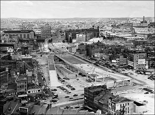
The legacy of urban renewal and white flight, too, has a role in the urban Left’s counterproductive support of the regulatory regime. Growing up in New Haven, and now living a block away from the marble edifice of the Empire State Plaza, the scars of this period have been ever-present in my life, as they are in the lives of many Blue City dwellers. When your physical environment constantly reminds you that your city is little cared for, and primarily designed for suburbanites to get into and out of quickly, is it any surprise that you may develop a mindset that has a hard time adjusting to a 21st-century reality where your city is growing again? The neighborhood associations that dominate white liberal middle class dialogue in many Blue Cities grew out of a period where no one–not government, and certainly not business–gave a shit about the communities that form in urban neighborhoods. They are, fundamentally, relics of a period where to be a middle-class urban liberal was to feel under siege. And they have thus had an extraordinarily difficult time adjusting to what should be their glory years–a time when the cultural narrative in the US has shifted to the opposite pole, from White Flight to The Triumph of the City. The urban left, then, clings to the things that gave it power 40 years ago after the era of freeway revolts and the end of urban renewal–legal protections from development, empowerment of the local community above all in business regulation, and just generally writing everything into law.

It’s really hard to give up power when you feel like it’s the only thing that’s been protecting your neighborhood for several decades. But now, those laws, regulations, and zoning decisions are counterproductive. Some (not all, but many) American cities are growing again. Young people want to live in the areas their parents or grandparents abandoned. And the urban Left, so accustomed to being suspicious of everyone and everything, is going to have to adapt.